

Beautiful mixed forests surround you as saunter up Indian Creek towards the Pacific Crest Trail (PCT). Surrounded by peaks on all sides, this crucial connector trail to the PCT in the ultra-rugged Glacier Peak Wilderness requires keen navigation skills (and a strong sense of adventure) as years of overgrown brush make this trail difficult to follow.
Begin your hike by crossing the mighty White River over a sturdy bridge and continue right, saving the trail up towards Mount David for a different outing. As you hike, take in the deep turquoise blue White River (courtesy of its origin from the White River Glacier). This deep blue is partly due to “rock flour”, a geologic phenomenon when glaciers grind down the bedrock it sits on and transports the sediment downstream as it melts.
This flour does not settle in the water due to its microscopic size. Instead, it remains suspended in the water and absorbs all colors of the spectrum except for green and blue, resulting in this vibrant color. So know that while this water is beautiful, it is frigidly cold!
This water stands in stark contrast to the lush, deep green undergrowth. Along with ample shrubs and plants, some massive trees, including a few cedars, line the trail, helping to keep you shaded during the summer months. After approximately one mile, cross the first moderate water crossing/log jam. Later in the season, this crossing will probably be dry, except in the dampest of summers. Continue through more mixed forest before you reach the confluence of Indian Creek and the White River, which you won’t see.
After crossing Indian Creek, the trail gradually switches back into the Indian Valley. Thankfully, this climb is very gradual. With decent trail underfoot and continued forest cover overhead, the climb is neither too long nor arduous.
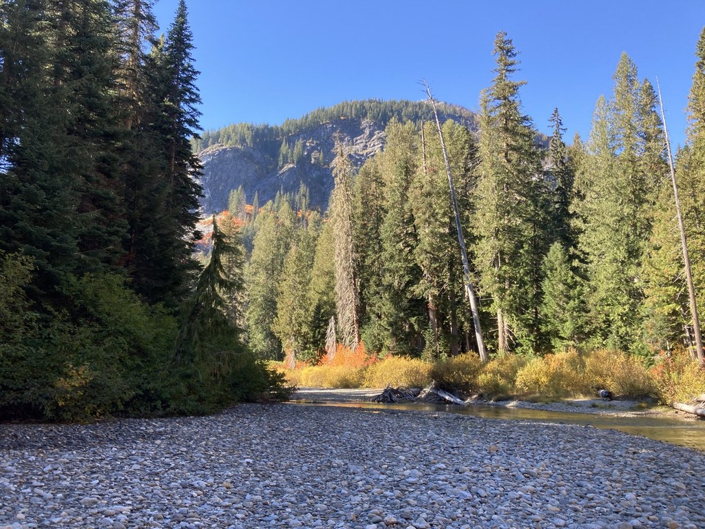
After about 1.5 miles of climbing, reach a slightly open area with very easy access to Indian Creek. This place serves as a great camp or turnaround spot for a day hike. Those who seek adventure will continue past this point.
Continuing west up-valley, hikers will begin to navigate dense overgrowth paired with open trail underneath a mixed forest canopy. While the travel in the mixed forest is quite scenic, the open areas of dense underbrush are just that: dense. At times, this underbrush is upwards of 8 feet tall and all but obscures any remnant of trail.
The majority of the time, hikers will be finding the trail simply by feeling with their feet, not by looking with their eyes. Losing the trail is easy, so navigation skills have to be dialed to their max on the trail. Despite these hardships on trail, views of many peaks and ridges on all sides of you beckon you further into the valley. Several campsites, one at 5.5 miles (which also starts the unofficial ascent up to Airplane Lake) and at 8 miles in offer hikers a chance to rest and camp as they continue to hike west.
For those who can push through the miles and miles of brush, you will be rewarded with a connection with the well-maintained PCT, beautiful views all around the Glacier Peak Wilderness, one of the most remote areas in all of Washington, and the ability to explore this vast, road-less area. Accessing the PCT in the Glacier Peak Wilderness can only be done on a few trails and Indian Creek is one of those trails. Despite years of chronic underfunding and minimal trail maintenance, hopefully Indian Creek will remain and serve as a vital entry point to the PCT and this rugged wilderness.

 Trailhead


