Trails for everyone, forever

Home Go Hiking Hiking Guide Ingalls Creek

Ingalls Creek

Central Cascades > Blewett Pass
47.4628, -120.6732 Map & Directions
Length
14.4 miles, one-way
Elevation Gain
1,450 feet
Highest Point
3,450 feet
Calculated Difficulty About Calculated Difficulty
Hard
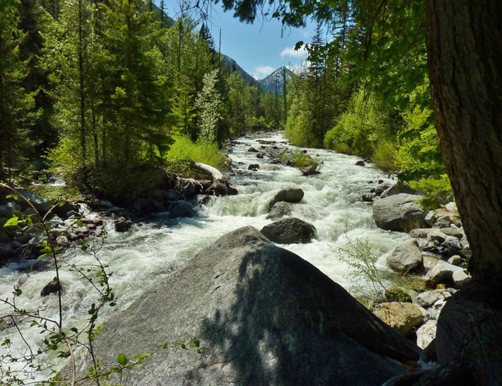
Ingalls Creek along the trail. Photo by jbk51961. Full-size image
  • Wildflowers/Meadows
  • Mountain views
  • Dogs allowed on leash
  • Established campsites
  • Rivers

Parking Pass/Entry Fee

Northwest Forest Pass
Saved to My Backpack

This popular trail parallels a thunderous creek on a gentle grade, making for an excellent springtime river romp. Continue reading

Rating
3.69 out of 5

(32 votes) Log in to rate

Hiking Ingalls Creek

The Ingalls Creek Trail features a variety of scenery that includes big pines, boulder fields, granite cliffs, old-growth and occasional views of the mighty Stuart Range. The primary attraction in late spring is the proliferation of wildflowers, some of which are uncommon. Be prepared for the cool breezes that flow down the valley, and carry an extra layer.

The trail is an excellent day hike and a good place to spend the night, especially if you plan to hike the entire trail, which leads to Stuart Pass (16 miles one way) and beyond. There are many excellent sites for resting or camping beside the creek — but you'll have to wait until the snow melts before attempting to reach higher elevations via this trail.

There is a gravel bar at Falls Creek, some roughed-in campsites, and a log that tempts crossing. This can be extremely dangerous during high runoff in springtime, and should be forded only during the summer months. If you want to see more beyond Falls Creek, continue up the Ingalls Creek Trail two miles and 300 feet to Cascade Creek, snow permitting.

The Ingalls Creek Trail is best enjoyed by hiking slowly in both directions and looking along the trail carefully for small flowers and fungi — but do look up and around at times because you may see elk in spring.

It is possible to follow the Ingalls Creek trail all the way up-valley, for a total distance of 14.4 miles one way. Multiple trail junctions along the way invite loop hikes and further exploration. Grab a map to plot your next trip to Ingalls Creek!

WTA worked here in 2018, 2017 and 2016!

Ingalls Creek

Map & Directions

Trailhead
Co-ordinates: 47.4628, -120.6732 Open in Google Maps

Before You Go

See weather forecast

Parking Pass/Entry Fee

Northwest Forest Pass

WTA Pro Tip: Save a copy of our directions before you leave! App-based driving directions aren't always accurate and data connections may be unreliable as you drive to the trailhead.

Getting There

From Cle Elum take Highway 970 east for 7 miles to Highway 97. Go north topping Blewett Pass. At milepost 178, turn left onto Ingalls Creek Road. Cross Peshastin Creek, bear left. The trailhead is at the road's end.

From Leavenworth, take Highway 2 east for 4 miles, then take a right onto Highway 97S and proceed for 7 miles before taking a right onto Ingalls Creek Road. Cross Peshastin Creek and bear left. The trailhead is at the road's end.

More Hike Details

Trailhead

Central Cascades > Blewett Pass

Ingalls Creek (#1215)

Okanogan-Wenatchee National Forest, Wenatchee River Ranger District

Guidebooks & Maps

100 Hikes in Washington's Alpine Lakes by Vicky Spring

Ira Spring & Harvey Manning (Mountaineers Books)

Buy the Green Trails Enchantments No. 209S map

Buy the Green Trails Liberty No. 210 map

You can improve or add to this guidebook entry!

Ingalls Creek

498 Trip Reports

Hiked here recently?

Submit a trip report!
 
Trip Reports