

A sub-alpine meadow teeming with wildflowers greets hikers who make their way up the Bean Creek Basin. Beginning along Beverly Creek as it tumbles past the trailhead, the trail then climbs up Bean Creek to the colorful meadow from which it is fed.
Consider using the restroom before making the drive, as there are no toilet facilities at this trailhead. The trailhead for Bean Creek Basin (Trail 1391A), which is shared with Beverly Turnpike Trail (1391), is clearly marked in the parking lot, starting next to a sturdy footbridge that crosses rushing Beverly Creek.
Before departing, fill out the free Alpine Lakes Wilderness permit and affix it to one of the backpacks in your party. You need this permit regardless of whether you are camping, hiking, or horseback riding.
Hikers share this trail with mountain bikes and horses, and it isn’t uncommon to see occasional evidence of the latter. Starting from the trailhead, Bean Creek Trail and Beverly Turnpike Trail follow a former road-turned-trail that travels through pockets of trees near Beverly Creek. Approximately a half mile from the trailhead, the two trails split. The Bean Creek trail following the sign to the right.
The dirt trail now follows Bean Creek and is largely exposed, climbing and providing views that alternate between the creek and the mountain hillsides that during portions of the year feed Bean Creek from snowmelt. There are five creek crossings along this section of trail, with several likely to be dry in summer.
The first creek crossing is of Bean Creek itself, which is approximately a quarter mile past the trail split with Beverly Turnpike Trail. Early in the year, the creek can be fast and difficult to wade through from snowmelt. In mid-summer, stones provide a drier path across.
On the north side of Bean Creek, the trail crosses three more creek beds that feed Bean Creek that often are dry in summer. Around 2 miles in, the surroundings become lusher and the trail crosses a much smaller Bean Creek a final time. Keep going straight on the trail until it reaches the creek crossing, as there are some unofficial, small trails that split off within the last 500 feet before the real crossing. Those unofficial trails are generally blocked off with rocks and logs to deter hikers from using them.
Immediately following the creek crossing is the trail junction with Earl Peak Trail (1391.1). Here, take a left and follow the Bean Creek Trail, ignoring the poorly positioned sign that appears to send you straight into a rocky hill. Following the trail to the right from the junction leads to Earl Peak.
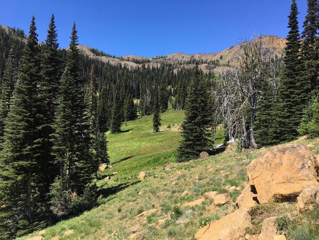
In another half mile, reach the wildflower meadow that is tucked in between Judi’s Peak, Mary’s Peak, Bean Peak, and Earl Peak. Colorful patches of thistle, paintbrush, lupine, gray’s lovage, corn lily, mountain monkshood, and more greet those who have climbed the 1,900 feet from the trailhead.
From the start of the meadow, follow the trail straight past an unmarked trail junction for a backcountry campground that is located in a stand of trees. The campground has more than four multi-tent campsites. There are opportunities for water on the west and southwest sides of the campsite, though by late-summer likely only one of the small creek beds has any water. Those looking to fill up may want to do so earlier when the trail crosses Bean Creek at the trail split with the trail that goes to Earl Peak. No formal toilet facilities are available at the campground.
Extending your trip: to add another mile roundtrip, climb the 800 additional feet to the ridgeline for views of ridges beyond. To get there, follow the trail that splits from the Bean Creek Basin trail just before campground. The trail heads north up the meadow and begins a very steep ascent up.
The trail up to the ridge is best climbed with hiking poles and features, in places, shifting rock and soil that will require care to cross. Those who choose to extend the hike are rewarded with a view across a valley to mountain range that separates the valley from the Enchantments and features Dragontail Peak, Little Annapurna, and Colchuck Peak. Mount Stuart is partially visible.

 Trailhead


