
This is an easy walk on a wide gravel and boardwalk path to views of Big Four Mountain and the caves beneath the snow. Hikers of all ages and abilities can enjoy this trail.
Note: Check the Big Four Ice Caves Snowshoe for the hike in winter.
Start at the trailhead parking lot and follow the paved pathway through the woods. Marvel at a large stump laying on its side, roots facing the trail. Soon you will come to an intersection. On your right, a boardwalk crosses a marsh and leads you to a flat grassy field and a picnic area. This is the site of an old hotel, but not much remains now except a large chimney.
To reach the viewpoint into the caves, continue straight, crossing the Stillaguamish River on an aluminum bridge high above. Look down and notice the old trail below. WTA helped create the new, higher trail you're walking on and the bridge was installed in order to withstand the flooding and washouts that have plagued this trail in the past. In a few steps you will cross Ice Creek, just before it flows into the Stillaguamish. The path continues on a gentle upward grade, on some gravel and mostly boardwalk through the forest.
Marvel at the power of nature in the swath of wind-snapped trees beside the trail. Continuing on, the trail breaks out into an open meadow beside a creek. You will now have a good view of Big Four Mountain and the waterfalls sheeting down the cliff face. Turn from the mountain for a minute and check out the wildflowers beside the trail. In late spring you will see trillium, then valerian, queens cup and some nice stands of bright magenta fireweed.
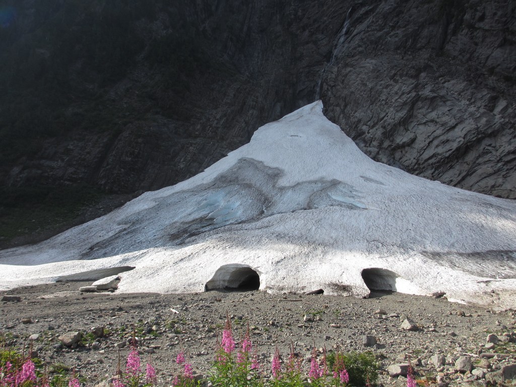
You now have your first view of the caves. Formed by melting snow, waterfalls from the above cliff and wind, they are really snow caves under an avalanche chute. Inviting as they look on a warm day, there are signs everywhere warning of the danger. Do not go into or climb on top of the caves! Other hikers may be doing just this, so parents, have your “Just because everybody else does it…” speech ready. The signs are there for a reason; people have been killed here as recently as 2011 by avalanches in the spring and collapsing snow bridges in the summer. There is a plaque at the end of the trail in memory of Grace Tam, an 11-year old girl who was killed in 2011. It serves as a reminder of the ever-changing nature of this area, and the potential for danger that the melting ice holds.
The trail ends in a circle of rocks perfect for safely admiring the caves, Big Four and the surrounding beauty. On your way back to the car, take the boardwalk across the marsh, watching for birds, dragonflies and frogs. Have a picnic, check out the old hotel site and call it a good day.
WTA Pro Tip: If you're planning on camping in the area, pack a thermos of hot cocoa, come back at night with a blanket to throw on the grass in the meadow and watch the night sky.

 Trailhead