A Vision for the Future of the South Mountain Loop Highway
After 5 years of work, WTA and a cadre of regional experts have completed the south Mountain Loop Highway Trails Vision. This report sets out a vision for the future of this beloved recreation area that is within a one hour drive to 4 million people. It makes suggestions for maintaining key access roads, increasing wheelchair-friendly trail options, maintaining currently inaccessible trails and more.
After 5 years of work, WTA and a cadre of regional experts have completed the south Mountain Loop Highway Trails Vision. The work is part of WTA's Trails Rebooted campaign, which is working to support popular trails and hiking areas. This report sets out a vision for the future of this beloved recreation area that is within a one hour drive to 4 million people. It makes suggestions for maintaining key access roads, increasing wheelchair-friendly trail options, maintaining currently inaccessible trails and more. Read the trails vision to see how WTA and the Forest Service are thinking about the future of your favorite trails in this area!
 Sunrise from Mount Pilchuck lookout, one of the most popular hikes on the Mountain Loop Highway. © Alex Pollitt
The southern half of the Mountain Loop Highway stretches from just outside of the town of Granite Falls to the Barlow Pass area. It is home to popular trails like Lake 22, Mount Pilchuck, Heather Lake and the Big Four Ice Caves, which can attract hundreds of visitors on nice days during the summer season. It also houses destinations like the Monte Cristo Townsite or Three Fingers, which are just as loved by hikers, but are much less accessible due to lack of maintenance and a need for sustainable site planning.
It’s a well-loved area, and it’s also an area that needs a lot of work. Deferred maintenance needs are more than $42 million for the Forest Service lands of the full Mountain Loop Highway. With such a pressing need for work in the area, WTA and our partners knew we needed to be thoughtful and prioritize what to focus on. What unrealized potential does the Mountain Loop Highway offer that can better meet hikers’ needs?
The south Mountain Loop Highway Trails Vision is that strategy to better meet hikers’ needs. The report makes high-level recommendations for trails, roads, bridges and more. It takes a holistic look at the south Mountain Loop and suggests a strategy for better caring for places.
So many voices and years of work have created this report, which will now inform Mt. Baker-Snoqualmie National Forest as they plan for the future. Having a region-wide report to attach to grant applications demonstrates community support for projects, which makes the forest a more competitive applicant for federal funding. The trails vision also offers the forest concrete recommendations that can be useful to reference when talking about the future of the Mountain Loop Highway with tribes and other partners. Both of these things turn the wheel on changes that improve your trail experience.
Here are some of the key priorities for the south Mountain Loop Highway that the vision sets out:
- Complete all critical trail maintenance, trailhead and road improvements on the most visited trails on the Mountain Loop (Big Four Ice Caves, Lake 22, Heather Lake and Mount Pilchuck).
- Add more wheelchair-friendly trails and improve those that are already available.
- Improve trails and roads in the Coal Creek drainage, including the area around forest road 4060, which accesses Coal, Independence and North lakes.
- Re-establish creek crossings to enhance trail access to the Monte Cristo Townsite and trail complex.
- Evaluate options for improved access to the Three Fingers trail complex.
- Focus on improving forest roads that access multiple trails, such as the 4060 and 4020 roads.
- Establish regional county partnerships that can support the funding needs highlighted in the report.
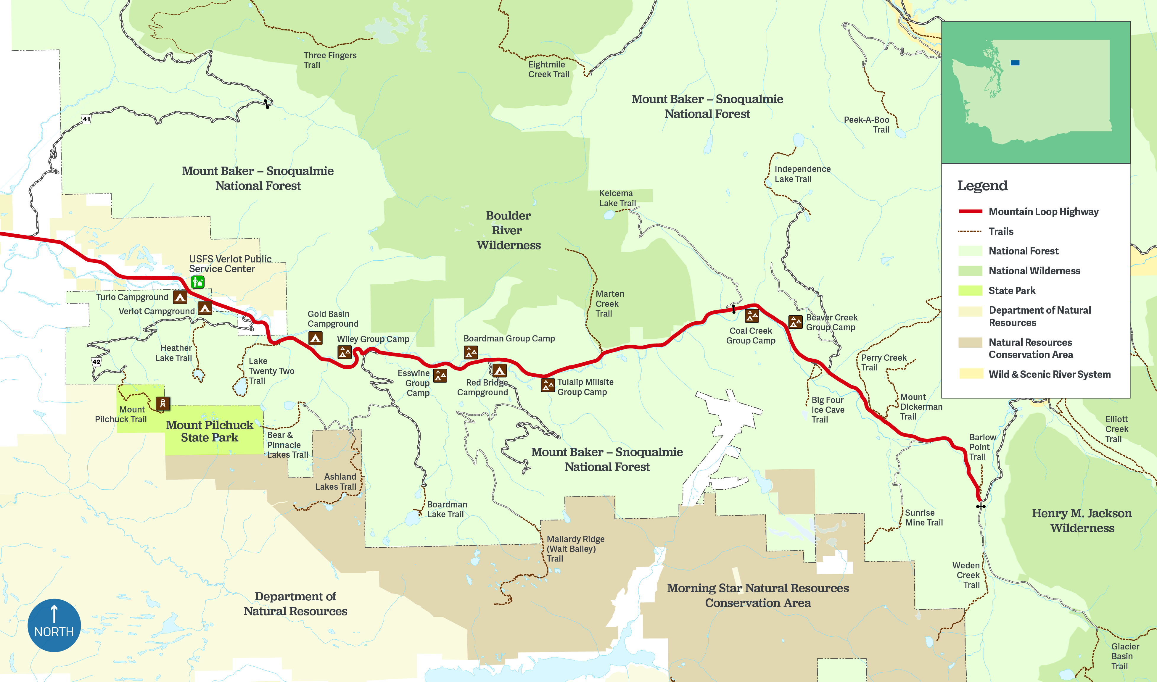
 Trails and recreation sites need to be re-designed, enhanced and expanded to steward natural resources and meet demand along the south Mountain Loop Highway. Map by Lisa Homes of Yulan Studio.
At WTA, we know that looking holistically at a trail system’s needs can help land managers make decisions that improve recreation opportunities and protect resources. Since 2019, WTA has been working in close coordination with the Mt. Baker-Snoqualmie National Forest to consider how the south Mountain Loop Highway is loved and used, and what this means for the next decade of caring for its trail systems. The five-year effort to understand the needs of current and future visitors included convening a 10+ member cadre that included representatives from the Granite Falls Historical Society, the Access Fund, Pilchuck Audubon, The Mountaineers, and multiple community members. The work incorporated a visitor survey led by the Forest Service’s Pacific Northwest Research Station and a visitor preferences modeling study done by the University of Washington’s Outdoor Recreation and Data Lab. Tribes provided invaluable input to the process.

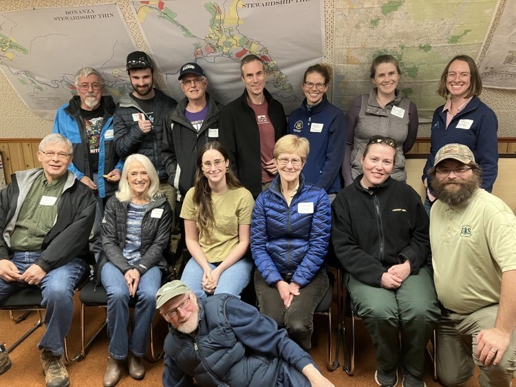
Members of the cadre gathered to celebrate the completion of the report on November 8, 2023 at the Verlot Public Service Center. Photo by WTA staff member.
The Mountain Loop Highway is just one area where we are working to create sustainable trail systems for years to come. We believe that sustainable trails are accessible, well-built and maintained, adequately funded and welcoming. Work like this is part of our Trails Rebooted campaign. We have done similar trail planning work for the Teanaway Community Forest and in the Southwest area.
If you’d like to learn more, you can read the vision. To stay informed as work continues on the Mountain Loop Highway and other areas, sign up for WTA’s Trail Action Network.


Comments
Really enjoyed reading the Vision Statement, learning more about future possibilities in the Mountain Loop. Just noticed one minor flaw: the text refers to Three Fingers and its nearby Meadow Mountain, but the Meadow Mountain photo is the wrong Meadow Mountain. The photo is from the Meadow Mountain far up the Whitechuck valley, east of RatTrap Pass. Many miles away from Three Fingers and the southern portion of the Mountain Loop.
Posted by:
Jim Liming on Nov 26, 2023 07:44 PM
Thanks for pointing that out, Jim Liming! We'll update the photo.
Posted by:
Washington Trails Association on Nov 30, 2023 09:49 AM
The plan for Mtn Loop Highway (south side) is great. It's too bad that the north side Mtn Loop Highway (beyond Barlow Pass if coming in from the south) has slid into such bad repair. This used to be a decent Forest Service Road all the way between Barlow Pass and Darrington.
Posted by:
Charlie Hickenbottom on Nov 30, 2023 06:38 PM
Great plans! My only disappointment is that the Robe Canyon Trail was not mentioned. I know it is county, not Forest Service, but it is a spectacular trail through an amazing canyon and railroad tunnel. However it now in disrepair and quite dangerous in places.
Posted by:
GaryN on Dec 01, 2023 07:08 AM
Go for it, please ! And take some of the pressure off us here in the North Cascades. -Eric, Mazama
Posted by:
Burr on Dec 01, 2023 10:45 AM
Was up at Three Fingers again this summer and I will add that FS road 41 is starting to wash away about another 2-3 miles before the current end at the bridge. The road is still passable but there is a good size chunk washed down the side.
I can fully understand not fixing the bridge and road passed the bridge (yes, just convert it into the trail), but if the FS can't find the money to fix the road up to that point, the trailhead may need to be moved those 2-3 miles further down the road in a few years.
The report is very good and thank you all for pulling it together.
Posted by:
cascadiacruiser on Dec 06, 2023 02:02 PM
Sorry, I just noticed the notification on the Three Fingers trail description that the road did wash out at the spot I mentioned in my previous post (4.8 miles from the MLH and ~3.5 miles from the current trailhead). This is really too bad.
Posted by:
cascadiacruiser on Dec 06, 2023 09:03 PM
I was very happy to hear a plan that includes bringing back online disued/closed trails and doing rd improvements in this area. For too long it feels like trails and roads have been steadily closing or deteriorating with only minor annual matinence being done. Looking forward to volunteering for a trail crew in spring/summer.
Posted by:
Keeponchuggin on Dec 14, 2023 12:54 PM
I would love to see the Bald Mountain Ridge Trail restored. I had the opportunity to walk a section of it earlier this summer and it is still intact for the part I was on. I understand it gets harder to follow after the West Peak of Bald Mtn. There are a few recent trips reports and one describes the entire route to Cutthroat Lakes. It's definitely worth a read if you haven't seen it.
https://www.wta.org/go-hiking/trip-reports/trip_report-2024-07-04.205519868884
Posted by:
RichP on Jul 24, 2024 08:41 AM