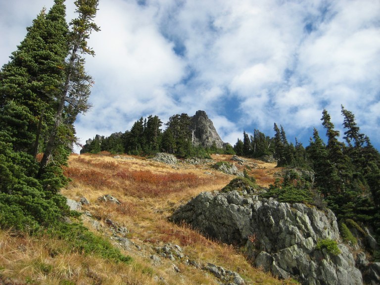
You are here: Home Find a Hike Hiking Guide Hibox Mountain

Hibox Mountain

 
Improve or add to this guidebook entry

Recent Trip Reports

Hiked here recently? Submit a trip report!
There are 24 trip reports for this hike. See all trip reports for this hike.
Hibox Mountain — Oct 13, 2011 — onehikeaweek
Day hike
Features: Fall foliage
Issues: Blowdowns | Overgrown | Mud/Rockslide | Mudholes | Water on trail | Snow on trail
Expand report text Hide report text
Flickr: http://bit.ly/hibox-mountain Hibox Mountain didn't make my climbing list until I took notice of it on the way to Alta Mountain...
Flickr: http://bit.ly/hibox-mountain

Hibox Mountain didn't make my climbing list until I took notice of it on the way to Alta Mountain a couple of months back. In merely two months, the taller peaks in the Snoqualmie area are now capped with snow. This was one of our "late start" hikes and I kept my fingers crossed for getting back before it got dark.

It wasn't long after getting on the boot-beaten before the elevation starting to pick up aggressively. A couple of tight sections felt as though I was climbing straight up a wall. From the trail it didn't look like there was much snow on the top and I was happy not to have to tread in the snow or break trail for the most part. Things started to look differently past the second rock band, and there was more snow than anticipated in the last 1,000 feet. Microspikes helped a great deal with gaining traction in spots with shallow snow, but I started postholing just before reaching the last 50-foot scramble in about two feet of snow. Assuming that there hasn't been any more snowfall since we were there, snowshoes will not be needed.

The scramble section looked pretty sketchy covered in snow and sheer icy, with two dogs I was not about to risk the fall and become a statistic. We turned around and got back down to the main trail just after sunset and spent half hour in the dark before getting back to the car.
Read full report with photos
Hibox Mountain — Sep 13, 2011 — foxterrierguy
Day hike
Expand report text Hide report text
Hibox is a thigh burner off the Rachel Lake trail, good details can be found here http://www.wta.org/go-hiking/trip-reports/trip_report.2010-08-18.2860460015 . Beautiful...
Hibox is a thigh burner off the Rachel Lake trail, good details can be found here http://www.wta.org/[…]/trip_report.2010-08-18.2860460015 .

Beautiful day above the clouds that socked in the Puget Sound basin. Here are some random observations:

Not tons of berries but what there are are high quality - best are the mid elevation huckleberries. Atmosphere here is dry and slope is exposed. Dehydration is a problem to be extra prepared for. Ruby (my little dog) and I consumed over a gallon of water and Gatorade and I still wished I had more. Very few bugs, mostly flies and horseflies. The trail is as good as always, which is to say, it's steep, slippery, rocky, rooty and brush, usually in combinations of three or more and always including steep. Stay to the right of the summit block and take the ridge to the top, don't bother with the gullies, you'll get stuck. You can see the wind turbines near Ellensburg on a clear day like today as well as all the way west to the Olympics. Really a spectacular vantage point at the top and on most of the journey. Although I got my one little dog to the top, the summit is not very dog friendly. A big dog would be a challenge, possibly dangerous. Two dogs...wouldn't try it. They need help with the class 3 scramble. Tucker stayed home (under protest). He is having leg problems and is done for the season I think. Still some snow on the north and east side of ridges. I could see that Rampart Ridge still has a lot of snow fields. Saw one guy on the Rachel Lake trail and a few cars in the lot. Flowers are almost done but this is a spectacular fall hike as well.

.
Read full report with photos
Hibox Mountain, Rachel Lake — Aug 30, 2011 — ann
Day hike
Features: Wildflowers blooming | Ripe berries
Issues: Blowdowns | Overgrown | No water source
Expand report text Hide report text
This is a great scramble, as long as you dont mind STEEP, as in Aasgard Pass steep for 3500'. The...
This is a great scramble, as long as you dont mind STEEP, as in Aasgard Pass steep for 3500'. The summit ridge is airy but not difficult as long as you find the right route and check your handholds carefully for looseness.

The first 2.6 trail miles are on the Rachel lake trail, and in an unusually lovely old growth forest. Not much elevation change on this part. Then the climber's trail acsends 3500' in 1.3 miles. The whole trail is interesting and pretty, with huge trees on the lower part and varied vegetation and views.

The route is very well described in the August 2010 trip report by Don at http://www.wta.org/[…]/trip_report.2010-08-18.2860460015 . The trail through the upper meadow does become indistinct but as long as you keep heading to the right of the summit block until you get to the ridge and dont get tempted into trying any of the gullies you'll be fine. A party of 5 young men started ahead of us but ended up behind because they got off route, and they reported that the gullies are not the way to go.

Lovely cool day with no biting bugs. It was foggy and drizzly on the west side of the crest but we had mostly sun.

Read full report with photos
Hibox Mountain — Aug 19, 2011 — PeterV
Day hike
Features: Wildflowers blooming
Issues: Blowdowns | Overgrown
Expand report text Hide report text
My friend Dave and I set out to do Hibox. Following the other trip reports on how to get there...
My friend Dave and I set out to do Hibox. Following the other trip reports on how to get there was easy. The turn off after the 2nd major clearing was obvious. The boot path is full of blow-downs the first mile. Once up to the meadow area the path is quickly lost and sometimes found again.

We noticed more pink ribbons on the way down but they are sparse and the trail really is overgrown or simply eroded due to moving rocks and dirt.

One mistake we made was near top of the meadow, right before the summit block we went to the left at a thick band of trees. You really should go to the right even though it doesn't look like much. You'll find the trail again and it heads up and to the right around Hibox.

You need to get to the top of the ridge on the right of Hibox. Once there you will see a nice little stair case (sort of) that is almost 2 feet wide. Going up this way was really simple.

We had 360 degree views at the top. You are above most other peaks in the immediate area and we could see Helens and Rainier very clearly.

When going down the mountain, it was easier to find the so-called-trail through the meadows. Even though it disappears a few times it certainly speeds things up follow it.

It was a really good hike and if you're in the mood for something challenging and rewarding, then this is the hike for you.
Read full report with photos
Hibox Mountain — Aug 18, 2010 — foxterrierguy
Day hike
Features: Wildflowers blooming
Issues: Overgrown | No water source
Expand report text Hide report text
I returned to Hibox without the dogs to finish what I started last summer. I went up last year...
I returned to Hibox without the dogs to finish what I started last summer. I went up last year on a cold, windy day and took a 'false' summit gully and ultimately decided to stop a few hundred feet short of the summit since I was cold and couldn't see a way to get me and my dogs on top.

Armed with better knowledge of the summit scramble, I set out on a warm morning and made my way up the (very) steep trail. "Don" does a nice job of describing the full route here http://www.wta.org/[…]/trip_report.2010-08-18.2860460015 , so I won't repeat the details.

I will reiterate that you will want to swing right as you approach the summit block and make for the ridge. You'll find the trail to the ridge or on the ridge and the scramble route is pretty clear from there.

I take back what I wrote about the views last year, they ARE really nice from the summit. There was alot of haze from a fire near Mt Stuart that mucked things up a bit, but I was still impressed with the vantage point.

As I thought, the summit would not be an appropriate place to bring your dogs. My legs are sore today, testament not only to the steep grade but the loose dirt and rock or pine needles that covers most of the trek and forces nearly every step to be carefully chosen and constantly tensed against sliding. It's really kind of a crappy trail which is one of the charms of this hike. It's not a technical climb, but it's also not an easy prize, and you'll probably have it to yourself, like I did.
Read full report with photos
Hibox Mountain by Doug.jpg
The summit of Hibox Mountain comes into view. Photo by Doug.
Location
Snoqualmie Pass
Features
Summits

Improve or add to this guidebook entry

Map it
Red Marker Hibox Mountain
47.4007602351 -121.284041405
(47.4008, -121.2840) Open in new window
Document Actions
  • Email this page
  • Print this
  • Share
Log in


Forgot your login name or password?
New user?


Email Newsletter

Get Trail News each month hiking tips, trail ideas, action alerts.

Connect with us

Facebook_icon2 twitter_icon RSS_icon

Featured Member
Footer
powered by Plone | site by Groundwire and served with clean energy