

If the name Kendall Katwalk conjures up an image of a narrow pathway blasted out of a steeply sloped rock face, that’s part of it. But the whole package includes old-growth forest, gorgeous wildflowers, and stunning views into the Alpine Lakes Wilderness from both sides of the pass below Kendall Peak, where the Katwalk begins.
Start out from the Pacific Crest Trail (PCT) main parking lot, turning left at a picnic table in the shade, and coming upon a ‘T’. Stay to the right; the left is merely the connector trail from the upper parking lot. In another 100 feet, pass a gravelly overgrown trail on the left. This is the unmaintained Commonwealth Creek Trail, a portion of the original Cascade Crest Trail, the precursor to the PCT.
You'll continue on along the wide trail, climbing gently past the lush and varied vegetation lining the trail. In late August or early September, blueberries are a treat. The trail winds around at first, then heads into a series of lengthy straight sections. The second section passes through forest still exhibiting damage from the summer storm of 2011, when the trail had to be closed briefly in order to clear gigantic blowdowns.
Approaching the 2-mile mark, the trail breaks out into open talus, enters the Alpine Lakes Wilderness, then begins slowly dropping 100 feet. At 2.25 miles, a small waterfall on the steep uphill side of the trail alerts you to the stream crossings ahead. Two sequential crossings are aided by good balance and/or trekking poles. In high runoff, there is not enough room to avoid minor splashing. As always, be safe when crossing high water, and if it seems too much for you, don't be afraid to turn around.
500 feet beyond, stay right at the signed junction and climb to a switchback, entering shady forest. After crossing a stream (the same one as below), the trail briefly follows a gravelly runoff bed into a rock formation. The trail can be lost here; watch for where it dodges sharply to the right, sometimes hidden in shadows. Continue on through old-growth forest, where blacktail deer roam stealthily.
At 4.25 miles, cross a nearly flat ridge top where large fallen trees bear evidence to a past storm. Camping is possible here, but there is no water. Traverse a steep hillside through beautiful old-growth forest, eventually breaking out into open talus at about 5000 feet of elevation. In season, the slopes feature a dazzling array of wildflowers, including lupine, paintbrush, phlox, penstemon, and columbine. This area is affectionately known as Kendall Gardens. The trail is steep, rocky, and exposed, offering unobstructed views of Lundin Peak and Red Mountain ahead, and Mount Rainier behind. At 5400 feet, the trail turns a corner to the right and changes heading to almost due east. Along the final up-and-down half mile, lingering snow can make the way treacherous; check trail conditions.
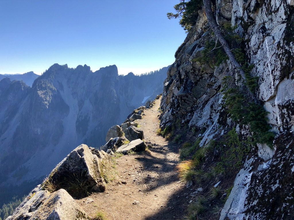
Cross the pass below Kendall Peak and welcome new views. Walk the narrowest portion of the Katwalk if you choose (150 yards). Or just drink in the views of Gold Creek Valley and the peaks of the Alpine Lakes Wilderness.
Extending your trip: If just seeing the Katwalk leaves you unfulfilled, consider continuing another 1.25 miles to a pair of lakes. The rock faces of the Katwalk gradually transition into a more mellow soil and vegetation traverse. Pass through a small talus slope, staying at about 5400 feet of elevation for most of a mile, then dropping 150 feet to small Ridge Lake, beside the trail. To the north-northeast and about 175 feet below the trail is the larger Gravel Lake.

 Trailhead


