
- Trail smarts

- What to Bring: Day Hike Packing List
At the trailhead, set out on a well-maintained track that quickly becomes a mountain rainforest trail. Substantial effort has gone into building a trail that can withstand the perpetual beating from the arch-enemy of all trails, water. Gravel, turnpikes, stone steps, puncheon bridges and more turnpikes make a sustainable trail surface possible. There is always "water on trail" here, but the dampness allows ferns and moss to flourish in the Mountain Loop rainforest, and provides a trail environment fascinating to little ones.
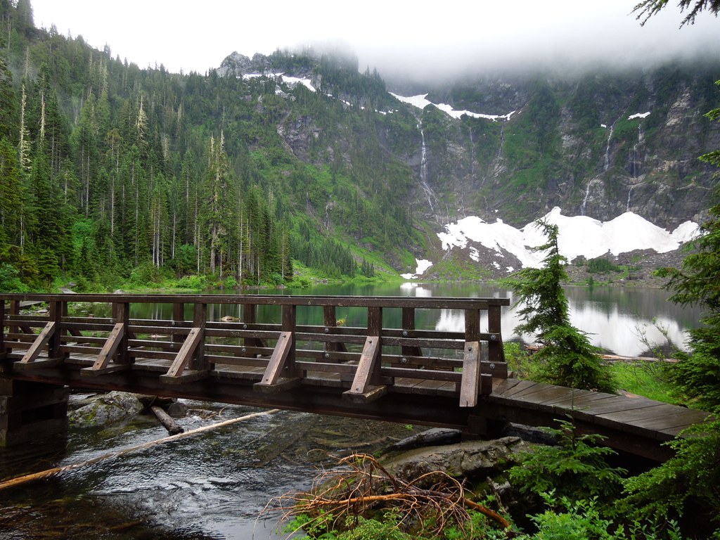
The trail climbs steadily through the forest of western hemlock, mountain hemlock, alder, and red cedar. Old-growth hemlock and cedar giants have managed to persist due to the RNA. Substantial segments of the lower trail cross active creekbeds, so plan on wearing footwear appropriate for fording small creeks. At 0.6 mile, there is a bridge crossing over 22 Creek, giving your boots a break from keeping your feet dry. But the ample water supply keeps salmonberry, thimbleberry, bunchberry, arnica and bleeding heart growing thick all along the way. You are never far from the rush of water, and several waterfalls are located close to the trail.
At 1.5 miles, leave the forest and climb a talus slope, where western columbine makes an appearance in the summer. This middle segment offers views of Whitehorse Mountain and Three Fingers on clear days. Trudging onward, reenter the forest at 2.1 miles. Shortly thereafter, the terrain takes on a wetland character, with skunk cabbage blooming in the spring. When you reach the bridge over Lake 22's outflow, you have traveled 2.7 miles through lush rainforest. Marvel at the sheer northern face of Mount Pilchuck, with its waterfalls and (sometimes) booming avalanches in winter and spring. Take in the reflections of rock, sky and evergreens on the surface of a pristine alpine cirque.
The origin of Lake 22’s distinct name is uncertain, but a leading theory is that nineteenth-century railroad maps listed local creeks numerically; one particular creek and its source lake were assigned "22." The name stuck, and in 1947, the 790-acre Lake Twentytwo Research Natural Area (RNA) was created, putting an end to logging and allowing future generations to appreciate the remaining old-growth cedars and hemlocks. Another theory suggests 22 simply signifies the section of forest that the lake is located in.
WTA Pro Tip: There is a trail around Lake 22, but please keep to it. The boulder field above may be tempting to scramble, but it is dangerous to navigate. Fatalities have occurred when groups of hikers have ventured up the boulder field.

 Trailhead