The multi-use Lightning Creek trail is a mostly valley walk through a recovering forest from the 2006 Tripod Fire and 2014 Carleton Fire, going from a lower trailhead on Forest Road 4225-200 to a higher trailhead on FR 4235, crossing FR 4230 at 4 miles. The trail quality degrades as it climbs up the valley, becoming more sandy and troughed due to mountain bike and motorcycle use.
The trail starts from the berm at the washed-out Volstead Road (FR 4225-200, elevation 2870 feet). The first 3 miles are through part of the Carleton Fire area. It goes through the abandoned dispersed camping area, staying right to cross Volstead Creek. (This crossing can be difficult in high stream flows, as indicated by the washed-out road.) At the road sign for the Lightning Creek trail, go to the right (east-northeast) to continue along the North Fork Beaver Creek.
The first 1.5 miles along Beaver Creek is a mostly shaded hike with flowers in the spring and the sight and sound of North Fork Beaver Creek. Just after the bridge over North Fork Beaver Creek, there is a nice log bench for a rest (elevation 3230 feet).
A short distance above the bench is the junction with Blue Buck Trail (#421), which takes off to the north. Just beyond the junction is the first ford of Lightning Creek. In spring, this ford is 1-2 feet deep and about 30 feet long. About 0.2 mile beyond the first ford is a second ford of Lightning Creek of similar depth and length. Most hikers turn around at the first ford.
For the first 0.9 mile after the second ford, the trail climbs away from and stays well above the creek on the steep slope, going through the surviving forest of pine and Douglas fir. The trail is slightly affected by the wheeled traffic, but still in good condition.
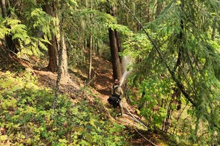
For the next 0.7 mile, the mostly sandy trail is along the boundary between a moister forest with underbrush below the trail and a drier forest with sagebrush and grass understory above the trail. This area has not been affected by a recent fire. Shortly before reaching an abandoned road, the trail steepens with the sandy surface making the climb more strenuous.
The 0.7-mile walk on the sandy, abandoned road is forested, providing some shade.
At 4.0 miles from the lower trailhead, the trail reaches FR 4230 (elevation 4300 feet) and follows it east for 0.1 mile. This road was used as a fire break to keep the 2006 Tripod Fire from descending into the valley.
The signed continuation of the trail is on the left, and the rest of the trail is in the recovering forest from the 2006 Tripod Fire. The next 0.5 mile is on an abandoned road, troughed by wheeled traffic through a mix of brush and young forest. About 0.1 mile before the end of the abandoned road is a peek-a-boo view of the peaks to the southwest.
After the end of the abandoned road, the next 1.4 miles of troughed trail passes through a grove of small larches with a view of larches across the valley to the south. After an intermittent creek crossing, it finishes with a cut through a dense forest of young lodgepole pines, which creates a canyon effect. The trail reaches FR 4235 at its junction with FR 4235-200 (elevation 5240 feet). This is 5.9 miles from the trailhead.
WTA Pro Tip: Rather than doing the entire trail as an out-and-back hike, it is better to do the lower 1.5 miles as a short trip in the spring to enjoy the flowers. The upper 1.9 miles, between the road crossings, is better in the fall when the larches have changed to gold.
 Trailhead