

Longs Pass provides unbelievable views, but only after an unbelievable amount of elevation gain. In less than 3 miles, you'll climb more than 2000 feet in elevation -- that's quite like climbing a staircase for three miles. It's shady the first half, but soon comes out into an exposed area; bring as much water as you can carry!
From the Esmeralda trailhead, begin hiking on the multi-use trail for just 0.3 miles. This wide but rocky trail climbs 240 feet to the junction with the Ingalls Way trail. Since this trail also goes to wildly popular Lake Ingalls, you'll have lots of company as you step onto Ingalls Way trail.
Climb through sunny pine forest. Some of these "evergreens" are actually larches, and will change to gold in the fall. Switchback steadily uphill for 1.4 miles, gradually losing the shade of the trees for the sunny slopes above. Arrive at a junction at 5440 feet, where a sign points the way to Longs Pass.
The crowds will likely continue straight on to Lake Ingalls -- you can see the pass they're headed to off to the left, marked by burnt red rock. Look straight up though -- your trail is visible high above you, traversing through gray stone. It's a doozy from here, 860 feet up in 1.2 miles, and only a couple of switchbacks to assist your climb. Bring traction, there are a couple of "spicy" sections where loose rock makes for unstable footing.
Step onto the Longs Pass trail and begin climbing through exposed, rocky slopes, basking in the shade where you can find it. That high point you saw at the junction is a "false summit", the true pass is a little higher, but not visible. Keep at it, and take your time, until you reach the top.
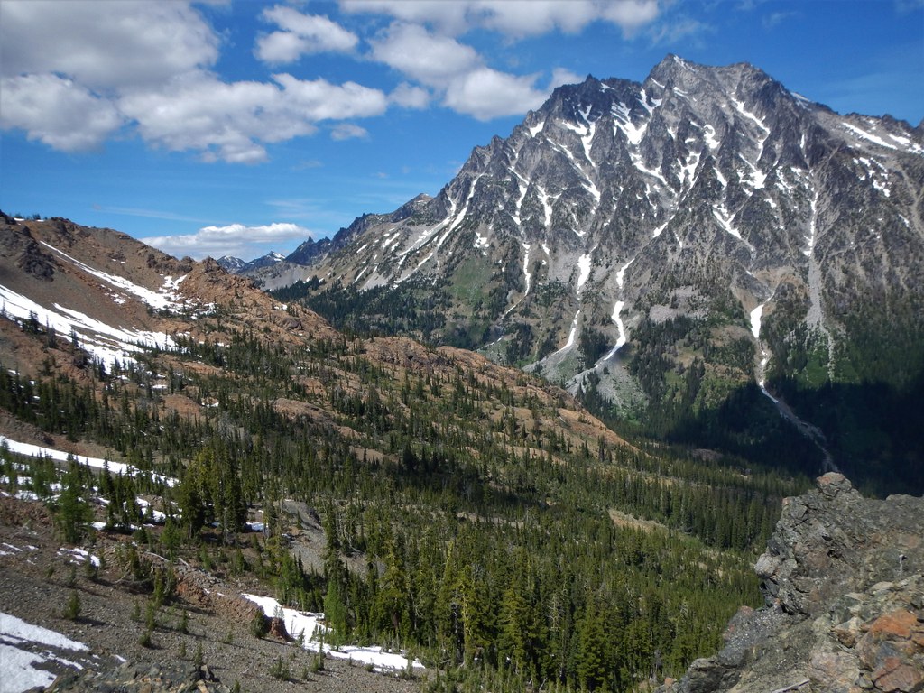
It's a knock-your-socks off view of Mount Stuart; just about as close as you can get to the giant massif and still see it from base to top. Take a breather in the small pass and have a snack before returning the way you came.
Note: Habituated mountain goats are in the area. If one approaches you in the pass, give it plenty of room and do not feed them. Photograph them from a distance, and do your best to let them go about their business without interacting with you at all. Dogs are allowed at Longs Pass, but not beyond the junction where the trail continues to Lake Ingalls.
 Trailhead


