
These mysterious mounds inspire imagination and speculation among visitors. With a half-mile ADA accessible path and another two miles of more rugged wandering, the Mima Mounds are a great destination for many hikers.
Many theories exist as to what created the Mima Mounds. Everything from geologic forces to extraterrestrial have been cited to explain the strange lumps that carpet the 445-acres of this National Natural Landmark. For a short, educational visit, head to the observation deck and half mile long paved trail. This is perfect for little ones, who may be more interested in speculating what created the mound than exploring them.
If you're looking for a more thorough exploration of the area, a 1.5-mile loop trail to the south wends among, around, and even over some of the mounds. As you hike, keep an eye out for the fluffy mosses and lichen, low-growing prairie grasses, and the charred remains of trees. These are the result of prescribed, managed burns carried out by the Department of Natural Resources, in the tradition of the Native peoples who used to manage the land in this area. It's an effort to manage not only native plants, but also the invasive Scotch Broom plant.
View of Mount Rainier and even Mount St. Helens are possible when it's clear. If the south loop wasn't enough, there's another half-mile loop to the north. Simply circle back to the observation deck and consult the map. The trail for the northern loop takes off a few steps to the west.
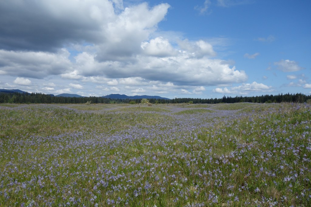
WTA Pro Tip: The Mima Mounds are an excellent destination in almost any season, but they're truly beautiful in spring, when camas and other wildflowers cloak them in beautiful purples and blues.
Mima Mounds

-
 Length
- 2.75 miles, roundtrip
-
 Elevation Gain
- 10 feet
-
 Highest Point
- 225 feet
These mysterious mounds inspire imagination and speculation among visitors. With a half-mile ADA accessible path and another two miles of more rugged wandering, the Mima Mounds are a great destination for many hikers.
Continue reading
Hiking Mima Mounds
Map & Directions
 Trailhead
Before You Go
Mima Mounds is currently open from 7 a.m. to dusk daily. The gate will be locked during closed hours.
Parking Pass/Entry Fee
Discover PassWTA Pro Tip: Save a copy of our directions before you leave! App-based driving directions aren't always accurate and data connections may be unreliable as you drive to the trailhead.
Getting There
Drive south on I-5 to to exit 95. Get onto Maytown Road heading west and proceed for three miles to Littlerock. Continue straight through a stop sign on Littlerock Road, and where it turns left, continue straight again onto 128th Avenue. After 0.7 miles, arrive at a T intersection. Turn right onto Waddell Creek Road and continue 0.8 mile. A sign for Mima Mounds Natural Area is on the left. Turn here and continue into the second parking area, where there are bathrooms available.


