
From Navaho Pass, the trail to Navaho Peak is siren-like, pulling you towards the summit long after you realize how tired you are. But for peak-baggers, or those simply interested in getting a gorgeous view from a relatively easy-to-navigate peak, the views are worth the extra effort.
After climbing to Navaho Pass, it’s almost intuitive to begin wandering up the County Line trail to Navaho Peak. The pass itself is beautiful, with views of the Stuart Range and Earl Peak filling your view. But it’s small, with not much room to spread out, and many a hiking group looking for a better lunch spot has found themselves climbing toward Navaho Peak.
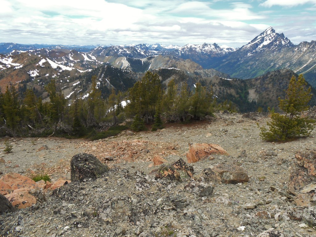
Head east out of the pass, paralleling the Stuart Range as you go. The trail is more or less straight up; a true climber’s trail. The loose scree and soil is anchored somewhat in place by various wildflowers, including Indian Paintbrush and pentstemon, as well as phlox. These provide a welcome distraction from the continuous uphill plodding, as do the ever-improving views of the Teanaway, Central Washington sprawling beneath you, and the gray, snow-dotted peaks to the north.
It’s a mile of climbing to reach the small summit of Navaho Peak, barely higher than a small rocky outcropping just to the east. Snow lingers up here into July, which can make the final push to the summit a bit of a route-finding endeavor, but once you’ve attained the summit, put on your windbreaker and enjoy the views.
Play a peak identification game: how many of the surrounding summits can you name? Rainier and Adams make appearances on clear days, but even Mount Stuart can be hard to identify from this angle. Below you, the County Line Trail stretches away, down the Ingalls Creek valley into Chelan county, inviting even more exploration in the form of multi-day adventures.
WTA Pro Tip: The summit of Navaho Peak only has room for about four or five people to sit comfortably, so if it’s a weekend, share the summit with other hikers who have made the same trek as you.
Navaho Peak

-
 Length
- 13.7 miles, roundtrip
-
 Elevation Gain
- 4,223 feet
-
 Highest Point
- 7,223 feet
9.3.25: The trail is closed until further notice due to the Labor Mountain Fire.
From Navaho Pass, the trail to Navaho Peak is siren-like, pulling you towards the summit long after you realize how tired you are. But for peak-baggers, or those simply interested in getting a gorgeous view from a relatively easy-to-navigate peak, the views are worth the extra effort.
Continue reading
Hiking Navaho Peak
Map & Directions
 Trailhead
Before You Go
9.3.25: The trail is closed until further notice due to the Labor Mountain Fire.
Parking Pass/Entry Fee
Northwest Forest PassWTA Pro Tip: Save a copy of our directions before you leave! App-based driving directions aren't always accurate and data connections may be unreliable as you drive to the trailhead.
Getting There
From Seattle, head east on I-90 to exit 85 for East Cle Elum. Cross the freeway on the overpass and turn right onto Hwy 970. Cross the Teanaway River bridge, and in seven miles turn left onto Teanaway Road. Proceed on Teanaway Road, bearing right where it becomes the North Fork Teanaway Road, followed shortly by unpaved Forest Road 9737 at 29 Pines Campground. At the first junction after crossing the bridge over Stafford Creek, turn right onto FR-9703, which is signed for Stafford Creek and drive 2.5 miles to the Stafford Creek trailhead.
There is parking here for about 20 cars in the lot, and parking is allowed on the road, but please keep in mind that other cars have to pass, so when parking on the road, leave enough room for traffic to get by. A toilet is available at the trailhead, as are daily Northwest Forest Passes.


