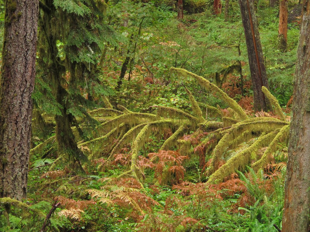

Take a hike within sight and sound of the wild Sauk River — part of the Skagit Wild and Scenic River System established to maintain the free flowing nature of Washington's rivers. You'll wander through a forest of moss-covered maple, cedar and fir, listening for wildlife and the sound of the river.
This is a nice flat walk any time of year, but it is outstanding as a fall or winter outing. Come in the rain and enjoy this one as moss drips off the trees, mushrooms pop up through the forest floor and clouds float among the low hills.
Start with a small jaunt upstream, hiking along a beautifully graveled trail. A short way down the trail, reach a signed junction for Murphy Creek. This spur wanders through the woods, over a little bridge and between two large cedars, where there are some nice spots to view the river. Once you reach Murphy Creek, the trail ends and you rejoin the road. The creek isn’t much, just another little feeder stream heading to add its waters to the mighty Sauk. But it's pretty, and a nice option for little legs.
Once back at the main graveled trail, follow it until it hits a regular dirt trail close to the river. The graveled trail is part of a new, one mile ADA loop, and worth taking for a short walk. To follow the trail along the river to the northern end, take the dirt path, along which you can hear the river, though it remains out of sight.
Enjoy the moss draped trees and green carpeted forest floor. In spring, look for twinflower and trillium. In fall, the yellow of turning devils club foliage, bigleaf maple and golden brown ferns add a splash of color to the bright green moss. How many kinds and colors of mushrooms can you find along the path? Mushrooms love the decaying wood of old stumps and leaves found here.
Since the river supports migrating steelhead, birders should keep an ‘eagle eye’ out for osprey and herons, and in the winter, eagles. Cross a wooden bridge, and catch a view of the river. There are lots of places to see its waters, and some access to its banks if you climb steeply down. This area was logged in the 1930s, and along this section one can see the remnants of old growth stumps, the springboard cuts barely visible. Notice some 100 foot tall trees that have grown from these old stumps. One grand old stump supports a vine maple, a hemlock, ferns and a huckleberry!
Reach the end of the trail at the north parking lot and turn around. On your way back, you will come to the intersection with the ADA graveled trail. You have two choices. You can go left along the lower part of the loop, and come out where you started, or go to the right and wind through the trees upward to the main parking lot on a different route. Either way, it’s pretty and green.
WTA Pro Tip: Do you have out of town guests? Make this part of a Mountain Loop day. Pick up picnic supplies in Darrington, then come and walk the short graveled loop trail. Enjoy your lunch at the nice picnic tables here. Continue around the loop, showing off the great Northwest scenery. Stop frequently, take many pictures, then visit the Ice Caves and have dinner in Granite Falls.
Old Sauk River Trail

-
 Length
- 6.0 miles, roundtrip
-
 Elevation Gain
- 150 feet
-
 Highest Point
- 800 feet
Take a hike within sight and sound of the wild Sauk River--part of the Skagit Wild and Scenic River System established to maintain the free flowing nature of Washington's rivers. You'll wander through a forest of moss-covered maple, cedar and fir, listening for wildlife and the sound of the river.
Continue reading
Hiking Old Sauk River Trail
Wheelchair Accessibility
The Old Sauk River trail is wide and flat and intersects with the Old Sauk ADA Loop. An ADA-accessible trailhead is available 5.4 miles from Darrington (described in the driving directions below).

WTA worked here in 2024, 2023, 2019, 2018 and 2017!
Map & Directions
 Trailhead
Before You Go
Parking Pass/Entry Fee
NoneWTA Pro Tip: Save a copy of our directions before you leave! App-based driving directions aren't always accurate and data connections may be unreliable as you drive to the trailhead.
Getting There
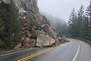
From I-5, take Hwy 530 to exit 208, signed for Arlington/Darrington and drive Hwy 530 to Darrington. At the 'T' intersection in Darrington, turn right onto the Mountain Loop Hwy.
There are three access points for this trail. Reach the first parking lot 3.6 miles from the intersection in Darrington. There is a parking lot, but no facilities here. In another 1.8 miles, reach the main trailhead. This is a large paved parking lot with several picnic tables, a toilet and garbage can. This is the access for the ADA portion of the trail.
The third access point is just a short ways further, a wide spot alongside the road by Murphy Creek, with room enough for two or three cars. Trail description begins from the middle trailhead.