

Take a trip back in time on this historic hike along Lake Crescent. This is a lovely lakeside jaunt for families or those wishing to stretch their legs on a long drive. With a microclimate of warmer and drier conditions than areas just a few miles away, this trail is a good hiking choice on an overcast afternoon.
This four-mile hike winds along the shores of nine-mile long Lake Crescent, whose character changes with the weather, but always provides an excellent backdrop to a hike year-round. This short hike is part of the much-longer Olympic Discovery Trail, which is a bikeable route that crosses the northern part of the Olympic Peninsula.
The route described below summarizes the up-to-10-mile roundtrip walk you can take on this short section of this trail.
The hike begins in an old orchard, chock-full of maple trees dripping with moss. Amble through the orchard, then drop down to a path that follows an old railroad. This was once a railroad used to haul Sitka spruce trees out of the depths of the forest, hence the hike’s name. Originally intended to manufacture aircraft in World War I, the logs wound up serving commercial logging interests for nearly forty years. When demand petered out, the National Park Service utilized the natural beauty of the area and turned four miles of the railroad bed into scenic trail.
And scenic it is. Winding through sunlight dappled corridors of maple, Sitka spruce, hemlock and countless other types of trees, with the lake lapping nearby, there is something to delight the senses every step of the way. Beach access is possible at several points, though occasionally hikers find themselves high above the lake, peering down nearly 40 feet into its crystalline blue waters.
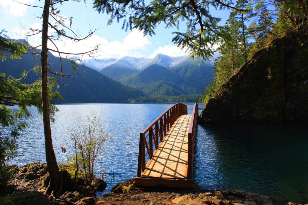
A main attraction of the hike comes only one mile in, but does require leaving the smooth path. Just before the tunnel, head toward the water on a sometime-rooty and rocky dirt path. A few minutes walk will take you to a large bridge spans a section of lake and to the right is a gorgeous, still pool — the Punchbowl. Photo opportunities abound here, so take some time to snap a few shots, then proceed on. The dirt path will rejoin the paved trail on the other side of the tunnel. 2.5 miles from the Punchbowl, there are nice views of Barnes Point and Mount Storm King looming above the lake. A further mile and a half leads to the western trailhead, where you can enjoy a short break before heading back, or pick up a car if you opted to shuttle your party back to the original trailhead.

 Trailhead


