

Stegosaurus Butte (Choir Boy) is a short, but steep well defined climber's path up off the Pratt Lake Trail to a small ridge with views of Garfield, Pulpit, and Preacher Mountains. It will get your heart pumping when you want to do more than meander the scenic Middle Fork Snoqualmie River Trail and a great alternative to more popular trails like Little Si or Rattlesnake Ledge.
To access this lightly traveled path, you begin at the trailhead for the Middle Fork Snoqualmie River Trail and cross the sturdy steel and wood bridge spanning the river. Take a right at the junction and began a brief walk on the Pratt River Trail past where it drops down by the bank. In a little less than a quarter mile, you will see a trail heading up the slope. It will be easy to spot, don't be fooled by several faint boot paths you might see before reaching this spot.
From here, the trail follows the fall line up gradually through second growth forest with a few remnants of the logging industry: rusted steel cables twisting out of the trail and old growth stumps with toeholds carved in the sides. The path is soft and needle carpeted, lined with sword ferns and moss covered stones. There are several side trails here off the main trail leading to lesser worthy viewpoints, don't waste your time.
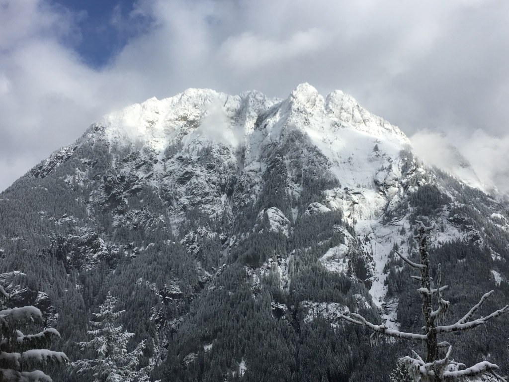
At about 1400ft, the trail changes gear and gains 625ft more earnestly on a path woven with roots that serve as sturdy handholds needed in spots as you make your way around larger rocks and trees crowding the trail. But this is short lived as you reach a short knob and the terrain levels out to a salal meadow interspersed with thin deciduous trees. A viewpoint of Garfield Mountain opens in front of you and the Middle Fork Snoqualmie River flows below through the trees. Watch your step, the ridge drops off steeply here as the side of Stegosaurus Butte is a slabby cliff down to the valley floor.
Although this offers a great scene to the north, you will continue on a short quarter mile further. The trail follows the ridge to the southeast down a small saddle and then back up to the summit 90ft above the knob. The summit itself does not have a well defined path because there are no views; the trail skirts it and makes its way to a ledge on the south side of the butte ending just over a mile from the parking lot. Here makes a great place to sit and take in views of Preacher and Pulpit Mountains while enjoying any snacks you may have brought along with you. This also has a steep drop off, so be careful while taking those summit selfies.
If you have your heart set on tagging the "summit", turn left when you first see this viewpoint and make your way on a short boot path up and over some slab rock to a small clearing in the trees at 2160ft. Then, makes your way back down the way you came and follow the main trail back to the parking lot. You can also extend your hike by following the Middle Fork Trail at the junction and in about half mile, gaze up at the butte from below and marvel at where you just were!
 Trailhead


