

With a moderate grade on a wide trail, the hike to Talapus Lake is the perfect introduction to the outdoors for hikers and beginning backpackers. Upon arrival at Talapus, break out lunch or pitch camp. If you feel like pressing on, Ollalie Lake is just about a mile and a half up trail, where open campsites offer lakeside havens with calm waters and views of a beautiful lake basin.
From the Talapus parking area, head into dark, cool forest on a wide trail. The grade is moderate, allowing you to enjoy the tall cedars and hemlocks all around you. The trail steepens soon, switchbacking up as Talapus Creek flows downhill to your right.
WTA crews worked on this trail for many summers, improving it to keep hikers' boots dry and the surrounding environment healthy. We helped create a more sustainable walk through the woods, and those who are deeply familiar with this area might just see some new sights thanks to the reroute. In order to keep the trail looking great, please stay on the trail, and don't cut switchbacks.
Just before crossing Talapus Creek, a fork greets hikers. WTA crews installed a turnpike here, a structure that helps keep hikers’ feet out of the muddiest areas, just before the lake. At this fork you have a choice: head left for access to campsites on the west side of the lake, or right for more lakeside access and the continuation to Olallie Lake. At Talapus, break out a snack, or lunch if this is your final destination.
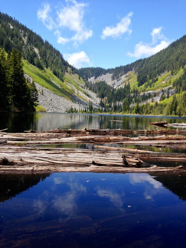
If you’re pressing onto Olallie Lake, stay on the trail at Talapus and switchback up the hillside through forest. 1.2 miles after leaving Talapus you’ll arrive at a junction. Crossing Talapus Creek via the right-hand path will put you on the Pratt Lake Trail after 0.2 miles, but Olallie Lake is attained via the left-hand path. Hike a slightly steeper grade for about 0.2 miles. Shortly after climbing, the trail levels out and Ollalie Lake appears to your right.
The trail stays high on the valley wall, but looking downhill you will see the campsites that dot the lake’s western shore. Head down to an unclaimed one and pitch camp, then relax in the shade of the trees and splash in the lake.
WTA Pro Tip: The popularity of these lakes has made wildlife in this area particularly used to humans. Respect the principles of Leave No Trace by not feeding the chipmunks or the gray jays (also known, appropriately, as camp robbers).
In winter
In winter, FR 9030 is closed to vehicles. Refer to the Talapus Lake Snowshoe entry for more information on this hike in winter.

 Trailhead


