
Tunnel Creek Trail has two trailheads. Nearly all hikers access the trail from the north side where for the first three miles the moderately easy grade is often within earshot of Tunnel Creek. After crossing the South Fork of Tunnel Creek, the route rises at a steeper but manageable grade past Harrison Lakes to 5050 Pass and some nearby viewpoints. The south side trailhead is on the Dosewallips Road. This segment’s notoriously steep grade to 5050 Pass means it is seldom used. Try it and you’ll find out why.
Most hikers access the trail from the north side where for the first three miles the route is often within earshot of Tunnel Creek. This route is 9.4 miles round trip to 5050 Pass.
Tunnel Creek has no tunnel. The name comes from the stream’s habit of not visibly flowing and leaving stretches of dry creek bed during low water periods.
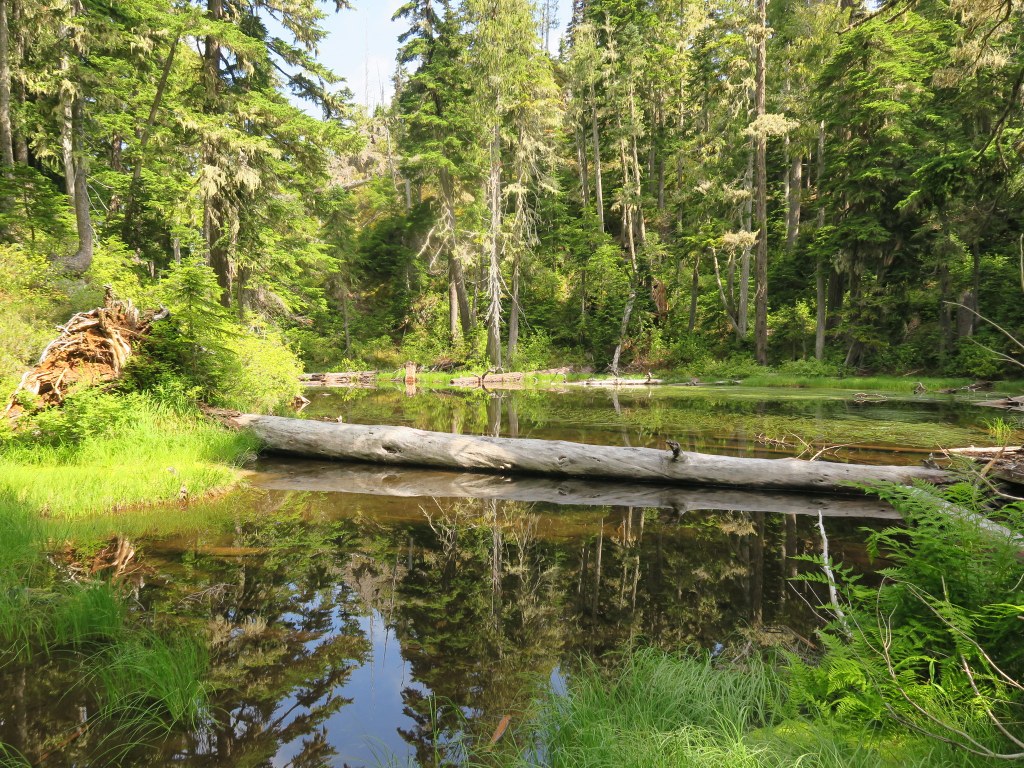
The path heads through impressive stands of Douglas Fir and Hemlock. The trees and the ridge of 5050 Pass to the south keep hikers in cool shade in summer and even cold in the shoulder seasons. At 2.7 miles Tunnel Creek Shelter offers several campsites. Soon you will cross the South Fork of Tunnel Creek on a short bridge that, because of the shade and spray, is often slippery. There are distracting views from the bridge of twin cataracts tumbling through moss carpeted forest.
From here the trail rises on the north face of the ridge, offering views of Mount Constance to the west that improve from peek-a-boo windows to sweeping panoramas at the 5050 Pass ridge top. The trail passes Harrison Lakes, shallow pools nestled into benches on the ridge. On nearly still days, their rippling reflections create Impressionist images of the surroundings. Pick an autumn day for the color show put on by the shoreline of azaleas and huckleberry bushes.
At 5050 Pass, there are two side trails along the ridgeline that offer even better views of Constance and more distant peaks and ranges. One trail runs east, the other heads west. You’ll figure it out.
Tunnel Creek

-
 Length
- 9.4 miles, roundtrip
-
 Elevation Gain
- 2,450 feet
-
 Highest Point
- 5,050 feet
12.24.25: The trail is closed until further notice due to the Tunnel Creek Fire.
Tunnel Creek Trail has two trailheads. Nearly all hikers access the trail from the north side where for the first three miles the moderately easy grade is often within earshot of Tunnel Creek. After crossing the South Fork of Tunnel Creek, the route rises at a steeper but manageable grade past Harrison Lakes to 5050 Pass and some nearby viewpoints. The south side trailhead is on the Dosewallips Road. This segment’s notoriously steep grade to 5050 Pass means it is seldom used. Try it and you’ll find out why.
Continue reading
Hiking Tunnel Creek

WTA worked here in 2025, 2024, 2023, 2022 and 2021!
Map & Directions
 Trailhead
Before You Go
12.24.25: The trail is closed until further notice due to the Tunnel Creek Fire.
Parking Pass/Entry Fee
NoneWTA Pro Tip: Save a copy of our directions before you leave! App-based driving directions aren't always accurate and data connections may be unreliable as you drive to the trailhead.
Getting There
Head south on US Highway 101 for the Ranger Station in Quilcene for 0.9 miles. Veer right to exit onto Penny Creek Road. In another 1.4 miles, the pavement ends and the road forks. Take the left fork and follow this gravel road for 1.3 miles where the pavement resumes as it transitions to Forest Road 27. Stay on FR 27 for another 1.3 miles before turning left on FR2 740. Follow FR 2740 6.6 miles to its end at the trailhead. There are no amenities at the trailhead.


