Hello, this is a trip report for an exit out the South Fork Cascade trail (#769) for a Ptarmigan Traverse team, July 2021.
My Mates and I did a Ptarmigan Traverse trip July 23-31, 2021. We were told the Downey Creek Trail was closed and so eventually settled on attempting to walk out the South Fork Cascade Trail as our exit. So this trip report is an account from the SF Cascade Glacier Research Hut down to the Cascade Pass Road, up the road from Mineral Park Campground.
Our initial PT trip was a success with one of our team grabbing Sentinel Peak, weather was gorgeous and hot, this route is without a doubt a challenge and delivers epic views. Check out my photo album link below.
Now for the Grit. We set out early on July 30th from the SF Cascade Research Hut, a cool place to visit on the ridge above the toe of the SF Cascade Glacier, thanks for the beers Bob! Right off we descend down to the headwaters of the SF Cascade River, this was a wade (1-2 feet deepest in AM). We then tried to find and follow the old existing trail. A note on this trail, in most places it no longer exists, this tail is best navigated using both paper and GPS maps, be sure to have the old USGS map with trail layer uploaded and you can follow off line, using satellite tracking you can position yourself along the trail and then look for the old and new flagging to navigate up or down the route. For some reason my GaiaGPS was not working as well on this day, it would not show on screen where I was, my teammates did not have this problem and I had to rely on them. In all this was to be an 11 hour total hiking day with approximately 5.5 miles gained.
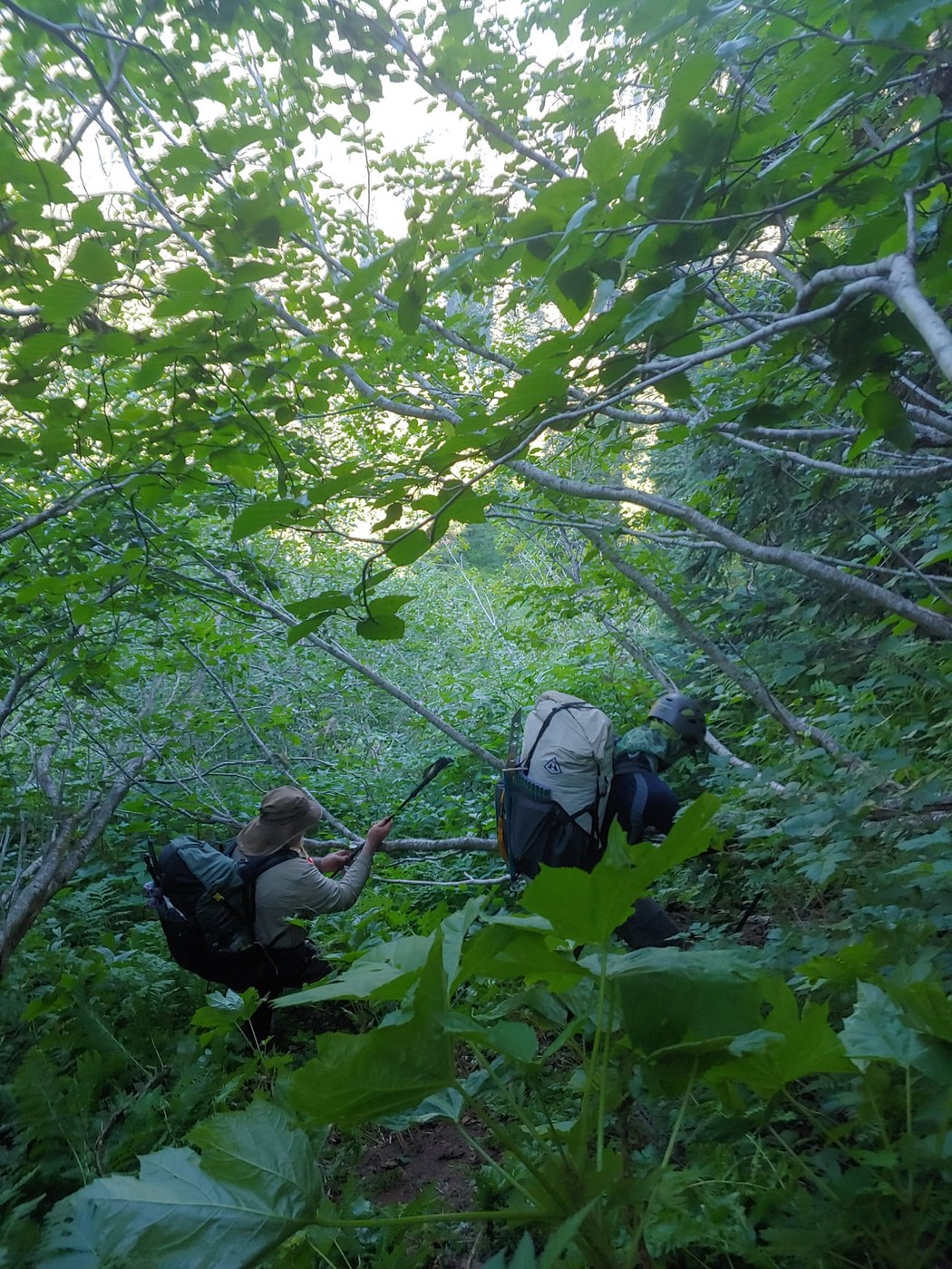
The first photo shows the view from the SF Cascade Research Station and our approximate route out. Note we were headed between the large ridge on the right and small knoll/hill in the middle of the photograph. The route to that knoll was mild, brushy, and manageable with a few meadows to cross. After that knoll, the "trail" took a steep dive downward, I mean steep. Again we were relying on the gps tracking to keep us on top of the trail. As we moved down we started to encounter a mixed conifer forest/hardwood mosaic on the landscape. The hardwood sections were all alder, vine maple and devils club which made some of the most challenging travel as you can imagine, brush so thick you could not see where to place your footing and we were often rolling down hill. Our strategy was to suffer these hardwood crossings and make it to the easier going conifer stands.
As the heat of the day kicked in we continued our hardwood fight frequently picking up a flagged trail and making our way down as best we could. The heat was intense, at first up high we had plenty of water, and we were confident that the tributaries coming off MT. Formidable would sustain us in the middle of the exit route. Wrong, do not count on water in the middle tributaries, they were all dry. As we traveled lower, it grew hotter and the great weather we had all week turned to fire hazy. We rationed water, took frequent breaks and agreed all around that the bushwack sucked. Luckily we found an avalanche chute that had snow in it, this saved us from over heating, we packed our hats and clothes with it and continued on. From there we continued downhill over some blow down until we reached the river, 2 miles before the confluence of the Middle Fork Cascade River. Exhausted, we called it a day and camped along the SF Cascade drinking all the water we can.
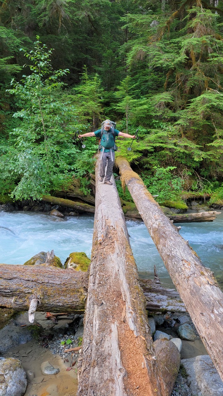
Day 2 was an easier 4 miles out. First the 2 miles to the MF Cascade crossing, the trail became easier to follow along the river with some recent brush clearing and extra flagging. The MF Cascade log crossing was easy enough and the trail afterwards up to the old road was positively enjoyable, by the standards of the day before. In all over two days this bushwack took us 14 hours.
In all, I would recommend the SF Cascade River trail as a PT exit, it is not easy, but it beats going back over the PT route or over Spire Glacier and down Downey Creek; either route would be a bushwack I am told. If you are looking to come up the SF Cascade trail to the research station prepare yourself for an epic and challenging bushwack this trail would be no joke and would require enormous commitment and grit. GPS tracking is a must as the trail and flagging are intermittent at best, conditions are hot and brushy and you would have to carry water. Give yourself 2 days at most.


Comments