Bottom Line:
Garibaldi Provincial Park, BC is a large park (~2X the size of Rainier National Park) that spans the coastal mountains between Squamish and Whistler (and beyond) BC. It is a volcanic landscape of cinder cones, lava plugs, volcanic peaks (Diamond Head), lava fields, glaciers, turquoise lakes and splendid summertime meadows. This trailhead is ~2 hours from Blaine WA (closer trailheads in Squamish, BC). First time hiking to Garibaldi Lake with winter conditions, and while ~1/2 of the trail was snow-covered with some snow bridges and fracturing to be cautious of, the lake did not disappoint. STUNNING. This area is maybe better known for summer hiking, with some of the best alpine views in all of Canada (hint: Google "Panorama Ridge")... all in a day trip from Bellingham!!
Stats:
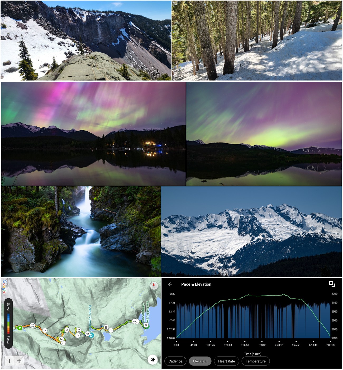
- Distance: 14.5 miles RT
- Duration: ~7 hours (did not want to leave the lake)
- Vertical: 3300 ft
- Road/Parking: Rubble Creek Trailhead parking lot is at the end of Daisy Lake Road off Hwy 99 about 1/2 way between Squamish and Whistler (~2 hours from Blaine WA in weekend traffic); two large lots with room for maybe 100 cars; during the summer months (beginning roughly mid-June) a day pass is required to park and to avoid overcrowding, available 2-days prior via the BC Parks website; only a handful of cars today; toilets; the gravel road is well-graded with no significant potholes. There is cell service at the trailhead, and intermittent service through "The Barrier" junction about 2/3rds of the way to the lake.
- Weather: Sunny and warm, from high-60s at lake to high-70s at trailhead, light wind; bugs were only bad at The Barrier (none at the lake itself); layers of very warm air throughout, with cool spots near waterfalls! (that water is frigid)
- Flowers: Not a lot of flowers out yet, and 1/2 the trail is still covered in deep snow (see pics). In the summer, Taylor Meadows up to Black Tusk and Panorama Ridge have amazing flowers, punctuated by turquoise tarns and creeks, but that will need to wait a bit yet. Very Hobbit Shire-like :)
- Water: There is water available along the trail, but with the deep snow it can be difficult to safely reach; the lake is also still frozen except near the outlet; we carried water, although we probably could have gotten by filtering (although glacial sift will clog your filter eventually)
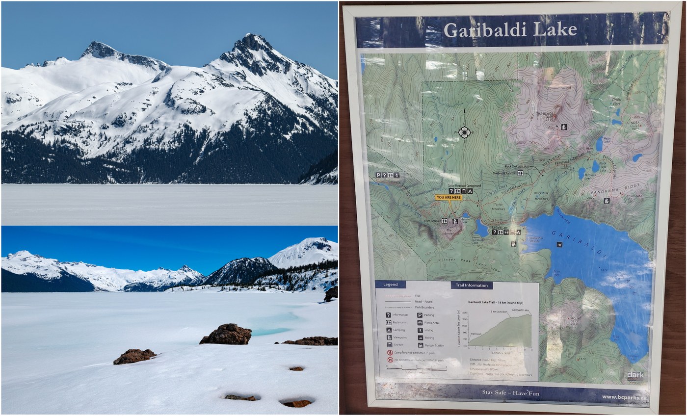
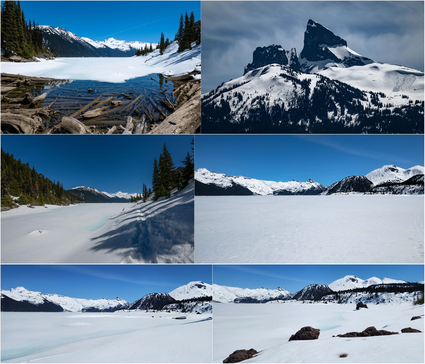
- Trail: The trail to the lake is ~6 miles, gaining 3300 ft. It never feels steep and is pretty mellow. This is like a US National Park trail - wide, well-graded and impeccably maintained. The ascent is through beautiful old growth. 2/3rd of the way to the top is "The Barrier" - a wall of rock that is holding in this massive alpine lake (up to 850 ft deep) that will one day fail with catastrophic consequences. There are warnings on Hwy 99 and the access road about the risk. From the (beautiful!) Barrier lookout, there was a lot of loud and dusty rockfall, and you would be forgiven for thinking you picked "the day"! Beyond the Barrier, you pass two smaller (frozen) lakes, and the trail becomes a little more hazardous with snow bridges and fractures that will eventually fall down the steep slope downhill from the trail. Eventually, you reach the lake basin, and it is otherworldly - a huge lake surrounded by peaks and glaciers (in many ways, more dramatic that Lake Louise in Banff). The "Battleship Islands" are simply mounds of snow in the lake right now. The dazzling emerald color of the lake is starting to show through in spots. There were numerous backpackers spending the night (although only one tent pad clear of snow) - I was envious as this would be an amazing spot for the aurora!! CAUTION: Black bears, thin ice, avalanche slopes and (an increasing number of) grizzly bears (although they seem to be mostly west of Whistler right now). Bear spray recommended. Right now, micro spikes are required. We left around the same time as a couple other parties that did not make it due to the snow (both had only running shoes!). My boots were soaked through by the time I returned, with a deep 18" layer of slushy snow around the lake where I did some trail breaking to get to the Battleship Islands. There are no dogs permitted on this trail. Other hikes reported that snow was too deep and soft to make it up to Taylor Meadows or Panorama Ridge.
- Takeaway: This trail is open year around, and I definitely need to come back mid-winter to snowshoe. There are still tracks on the lake from backcountry skiers, and there are two bookable huts at the far end of the lake. Some snowfield skiers were descending the trail after some sunrise skiing. In summer, one can bring a pack-raft and explore although I do not think I have ever seen anyone else on the lake. The far shores are wild... one thing about Garibaldi Park is that the interior areas are very remote. Panorama Ridge is long as a day hike, but camping reservations are challenging to come by!
The attached 4K video shows the trail and lake, as well as some of the sights through Squamish on the approach.


Comments
abhishes on Garibaldi Lake
This is Canada ... not Washington state.
Posted by:
abhishes on May 13, 2024 08:42 AM
206Hiker206 on Garibaldi Lake
Lighten up, abhishes, it's within a 4 hr drive of Seattle
Posted by:
206Hiker206 on May 13, 2024 10:55 AM
Hikin til I Drop on Garibaldi Lake
Don't like it? Don't go away mad--just go away.
Posted by:
Hikin til I Drop on May 13, 2024 11:52 AM
Hikin til I Drop on Garibaldi Lake
Great pics and trip report! Thanks for letting us know about what looks like a great hike within easy reach from here!
Posted by:
Hikin til I Drop on May 13, 2024 11:51 AM
Alpine Wanderer on Garibaldi Lake
Thanks! Summer is even more magical. This is a day hike from Bellingham/Blaine (if you can traverse Metro Vancouver) but probably an overnighter from Seattle. Then again, people drive all the way to the North Cascades to see larches for the day, so who knows! :)
Posted by:
Alpine Wanderer on May 14, 2024 08:43 AM