Bottom Line:
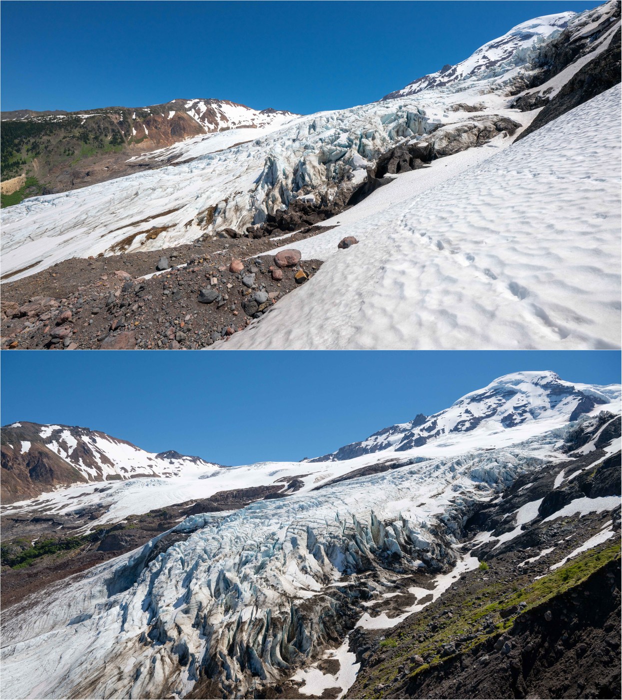
After a multi-year washout closure, NF-39 to the Heliotrope trailhead reopened last fall! This is a spectacular westside Mt Baker hike out of Deming, WA. Old-growth forest, waterfalls, meadows and glaciers - this one has it all!! It is early - the meadows are just starting to bloom - but there is lots of snow on the ridges and glaciers, making the views especially great. CAUTION: There are ~4 distinct creek crossings where water levels can rise fairly dramatically during the day in periods of hot weather - see warning signs at the beginning of the trail. This is recommended as a MORNING hike as a result. Snowfields to cross is you want to ascend the ridge.
Stats:
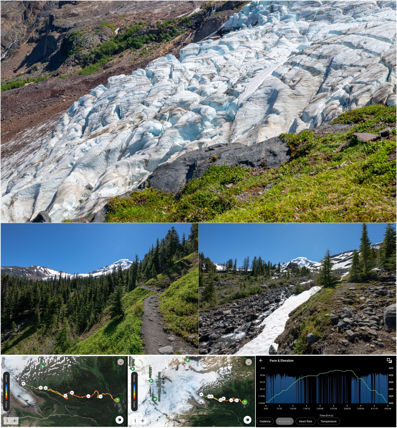
- Distance: 7-1/2 miles
- Vertical: 2070 ft
- Duration: 4-3/4 hours
- Road/Parking: The road is in fair condition, with some potholes but nothing that would prevent a regular car from making it to the trailhead. The repaired washout is evident early on. It is ~8 miles in on NF-37. The trailhead has parking for dozens of cars, with a National Forest Pass required. Toilets.
- Weather: Sunny and warm, with temperatures in the 70s (definitely an escape from the heatwave!) Light wind.
- Flowers: There are plenty of flowers on the road in, and at the trailhead, but the alpine meadows on this hike are just gearing up for a bloom. The glacier views will be especially beautiful once the meadows explode, although the white mantal on the glaciers will have melted more so the glaciers will be dirtier...life is about tradeoffs ;)
- Water: There is plenty of flowing water for filtering the length of the trail, so no real need to carry water. Cold runoff is the best on a hot day anyway! There are beautiful waterfalls the length of the trail right now.
- Trail: This is a very chill trail that is never steep or difficult. The ascent up to the meadows in beautiful old growth passes numerous pretty waterfalls (see video for a misty stunner on a hairpin turn). Once you reach tree line, the trail traverses across meadows and a set of creeks that can be challenging to cross during periods of high water. NOTE: If the creeks are too high, there is an option to take the "Climber's Route" up the meadows right when you reach the meadows (signed), and I would recommend this as an add-on once the meadows bloom either way. No problem with water levels today, but we stuck to the morning, and the creeks rose in the afternoon heat. The trail is muddy at times, and snowfields start in the meadows. One can traverse all the way to a ridge overlooking Coleman glacier, looking well downhill to the toe of the glacier, without any additional ascent. From there, ascend the ridge at high as you want. I like to go to the obvious icefalls, where one can stand meters away from the towering ice and waterfalls about, and there are numerous waterfalls among the ice. CAUTION: Loose pumice and snowfield traverses. I brought microspikes but did not feel compelled to put them on. My only fall was on the pumice. Also, the ice on the falls does... well... FALL... so careful when hiking close to the edge (big ice avalanche high above us while standing there).
- Takeaway: I cannot think of a hike in WA where you get such in-your-face glacier views without actually stepping onto the glacier. The payoff-to-effort ratio is off the charts for this trail!! Pretty easy, but oh so spectacular!! Once the flowers bloom, this trail is nothing short of AMAZING.
The attached video shows more of the trail, flowers and stream crossings, and does a better job capturing the grand scale of this perch than static pictures ever could! Sorry about the sky banding in that first pic - image compression at work!


Comments
Thanks for the detailed report, and especially the video. I wanted to do Heliotrope last weekend, but the stream crossings in a heat advisory steered me away as a solo hiker. Maybe next time!
Posted by:
Lukin 66 on Jul 08, 2024 11:08 AM
Understandable... the creeks were definitely manageable, but conditions can change. You still have a chance for optimal timing once the meadows bloom in the coming weeks - they were just starting the other day. Happy trails! :)
Posted by:
Alpine Wanderer on Jul 09, 2024 05:34 AM
Great report. Is there a special app you use on the still photos? Neat affect. I'd love to be able to create stunning videos like you do. Patty
Posted by:
PattyBee on Jul 14, 2024 04:41 PM
Hi Patty! Yes, I use "Animotica" to create my videos with a mix of video and still footage. It is super easy, and free unless you want to remove the watermark. It has allowed me to put together videos of a hike in 1-2 hours depending on how much footage I have. Have fun!!
Posted by:
Alpine Wanderer on Jul 15, 2024 09:00 AM