Bottom Line:
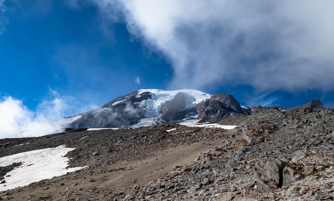
For photography, a challenging day on the mountain for sure, which was largely socked in from early afternoon onwards (heard it was clear first thing). To get above the fog one had to hike up Muir Snowfield to ~8500' (I had only planned to go to McClure Rock but had to go higher to break out). Panorama Point offered no views, disappointing a crowd mainly of tourists from other countries and states (I always feel bad when that happens). Beyond Pebble Creek, I only saw a couple skiers, although the snow conditions on Muir were less than ideal (mostly firm with lots of ridging). This is the maximum melt of late summer, and one could ascend to near Little Africa mainly on rock, with only a few mandatory snowfield crossings (microspikes and poles recommended). Take GPS as the trail is not really marked or obvious (especially in the fog) and you are sandwiched between two glaciers with adjacent cliffs that would be dangerous to stray onto. Fall color is just starting and is mainly on the slopes beyond Mrytle Creek when looping back to Paradise. Lots of yellow corn lilies, golden grasses and seeded western pasqueflower elsewhere.
Stats:
- Distance: ~9 miles (favoring rock over snow added distance)
- Vertical: 3200 ft (2/3rds of the way to Muir Camp)
- Duration: ~5 hours
- Road/Parking: The lot and road adjacent to Paradise Lodge and Vistor Center were mostly full, so I waited for spot at ~1:30pm, parking on the road. There was more room at the overflow back down the road. But pretty busy for a Thursday in September! The road parking was completely empty returning ~7pm. National Park Pass needed to get through the gates (credit card only), but no reservations required this late in season (bonus!). Nice to make a trip with by dirt road - just washed the Subaru! :)
- Weather: By early afternoon, Paradise was socked in and there were a lot of disappointed folks that did not see the mountain from Panorama Point. To get above the fog one needed to ascend to ~8500 on Muir Snowfield, but even there became socked in once the wind shifted from east to west. Chilly, with temps 40-50Fs. The rocks up high were still warm from the sun, but the air was definitely cold. Light wind. No bugs.
- Flora/Fauna: Deer, marmots (loud whistles startling me a couple times), grouse, a bear in the meadows, and gulls (which always makes me giggle a bit - are they lost?). The flowers are mostly done, but there were areas with pearly everlasting, aster, seeded western pasqueflower, explorer's gentian (freshest blooms) and arnica. Fall color was minimal (so far, and compared to what peak will look like), except for the meadows near Myrtle Falls, and on the drive-up Steven's Canyon with its stunning headwalls. Will take a few more weeks to get there. Some berries remaining. The meadows up high had more flowers and succulents, and there was a signed section up Muir marking a rock field with "vary rare" flower species (mostly past). Lots of yellow corn lilies (one of the first to turn) and a nice musty smell to the meadows. The grasses also are offering some yellow/gold color.
- Water: There is plenty of water on the trail for filtering, especially beyond Pebble Creek. I carried 1-liter spiked with an electrolyte tablet. Creek water of course was nice and cold!!
- Trail: Paradise to Panorama Point, then Upper Skyline back to Paradise in a loop, with a spur up to 8500' on Muir Snowfield via Pebble Creek. The trail is snow-free except for two mandatory snowfields up on Muir. Lots of folks on Upper Skyline, but virtually nobody beyond the spur to Pebble Creek and Muir Camp, except for 2 skiers I saw descending the snowfield. The trail is in good condition, even paved at the beginning, but the route beyond Pebble Creek becomes rough with some route-finding required. GPS, poles and microspikes recommended. A few muddy areas, and some snow hazards (postholing around rocks, creeks running under the snow, bare ice, and a note about crevasses opening up below Muir Camp). Some of the snowfield crossings were steep so I hiked around them, since I did not bring an ice axe (I have only planned to go to McClure Rock which is not far from Pebble Creek). Many pretty waterfalls, especially off the final ridge attained on the snowfield short of Little Africa. I mainly stuck to the snowfields on the way down as I could move much faster, although I did not glissade - I was so wet and cold after doing that descending from the summit of Mt St Helens earlier this summer!
- Takeaway: Mountain weather can of course change quickly. I had seen that it was clear up top on my drive-up Stevens Canyon, but could also see fog streaming in, so I took a risk that I could still climb out of it (a ranger had told me "No" on Lower Skyline). I have not actually ever hiked all the way to Muir Camp (on the list), but I was over 1/3rd of the way up the snowfield yesterday in distance, if not vertical. I had always thought the mountain views where better at Sunrise. The Paradise glaciers had seemed smaller, but getting closer the mountain today made the vista much more dramatic with some pretty spectacular ice falls and cliffs. The full hike to Muir Camp promises to be spectacular!
Attached a short video - limited by fog! May take time to convert to high-def.


Comments