Trip Report
Spring Lake/Lake Desire Park - Echo Mountain — Saturday, Jan. 3, 2009
 Puget Sound and Islands > Seattle-Tacoma Area

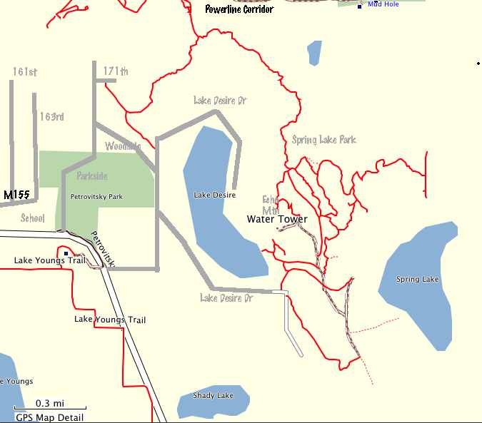
Around the Lake Desire area east of Renton is a surprisingly large series of interconnected parks and natural areas. These include Petrovisky Park, McGarvey Park Open Space, and Spring Lake/Lake Desire Park. The centerpiece of it all is a rugged little summit called Echo Mountain or Cedar Mountain, depending on which map you use. The peaklet feels much higher than its 880' elevation. Numerous trails wind through the parklands, offering miles of walking pleasure.
I did a nice little loop hike of about 5 miles. To start I parked near the intersection of Lake Desire Drive and Woodside Drive SE. Just north of the intersection was the start of a trail heading northwest into the woods. In a quarter mile, I turned left onto a unsigned but obvious side trail, and followed the well-maintained route as it weaved through dense second growth forest. The path crossed a paved drive (174th) then reached an somewhat obscure junction about a quarter mile beyond (look for some ribbons marking the junction). I went right (east) onto a more crudely constructed trail.
This trail made a long arc around the north side of Lake Desire, twisting and turning in the lumpy terrain. Midway along it crossed a stream with a beaver dam, using a uniquely constructed bridge consisting of a log with metal mesh on top. This whole trail smacked of mountain bikers--I think that they are its primary users and maintainers. Eventually the path joined into the extensive system of trails around Echo Mountain.
I headed for the top of Echo Mountain, which features a glacier-scraped bedrock bald on top. After enjoying the view from its summit, I continued hiking south first on a good trail (called the Peak Trail on one of the few trail signs around here that I saw), and later on a little driven service road. Tempting trails branched off every which way; there are miles of paths in this park. At length, I came to a trailhead parking area near the south end of Lake Desire, and to get back to my car I followed Lake Desire Drive (little traffic, not bad walking) back to the parking area near Woodside Drive.
There was not much snow when I hiked here, and probably there is none at all now.


Comments
Posted by:
dhisum_dhisum on Jan 18, 2009 09:40 PM
Posted by:
cookdoggie on Jun 06, 2009 11:12 AM