
Type of Hike
Day hike
Natapoc Mountain sits on the elbow of Highway 2 as it turns south towards Leavenworth, south of Lake Wenatchee. Views of the "Chumstick" valley and surrounding peaks appear at the ridge before the final approach. The bulk of the trail follows a powerline road, providing a hike that tends to be easy on the feet and knees. If you're at the lake and are searching for a stroll near some trees, you're unlikely to run into anything other than a few animals on this route.
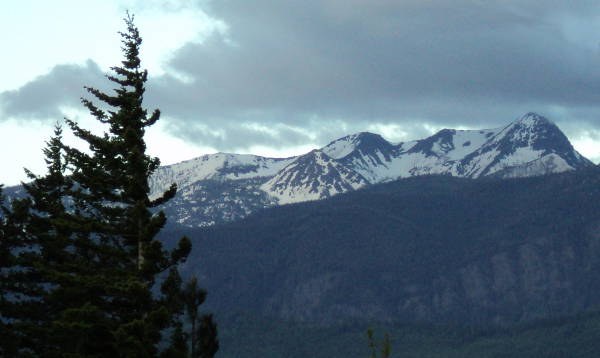
Checking a map first would be advised so you don't head off onto the wrong maintenance road, but the path is clear starting from the lower junction of NF-6601 and NF-850. Follow NF-850 until a turn south raises you onto the maintenance road, and keep a fairly fixed elevation or head up with the road when in doubt. Your first marker is where the power lines cross over the ridge, 1200ft up and 2.75mi from your starting point. Views of the snow on the Cascades are good from here.
Comments