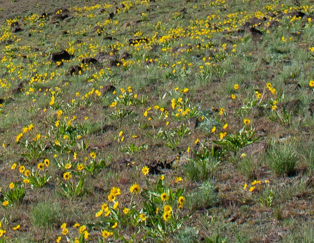
What we did: A variation of the WTA Yakima Skyline Ridge / Rim trail (http://www.wta.org/go-hiking/hikes/yakima-rim-skyline) -- a long, one-way trip from Umtanum Creek to Selah along the Yakima - Skyline Rim (from north to south on the west side of Yakima River). We started at the BLM Campground at Umtanum Creek where there is a suspension bridge (1336') across the Yakima River. From there we went cross-country uphill (south) to close to the high point of the ridge at about 3500'. Here we picked up the trail (sometimes road) that continues along the ridge. Next we descended to Roza Creek (~1275'). We then ascended to close to the top of the next hill, skirting the high point (3208') a hundred or so feet below it, after which we descended to the WTA-described trailhead at about 1300'. (Two of us went about 1/2 way to close to the end of the first hill - beyond 3500', but prior to the descent to Roza Creek. They then returned to the northern trailhead and subsequently brought our two autos to the southern trailhead. Thanks, guys.) Left Seattle: 7:15a ; returned to Seattle: 10:20p. Began hiking (north TH): 9:20a ; finished hiking (south TH): 06:50p. Flora: many wildflowers of many different species including several barrel (or barrel-like) cacti. Fauna: 4 deer; no ticks; no snakes; no mountain sheep. General comments: great trip - very scenic. Visibility: locally, pretty good ; distance: not so good - couldn't see Mt Adams or Mt Rainier Weather: chillier than I had expected (50's ?); cloudy with sun breaks. Vertical and horizontal: 4544 feet total elevation gain; 15.5 miles (one way) Google Earth Image of route (provided by Scott): See link below - north is up Suggestion: If you are interested in doing an out_and_back trip, I suggest doing it from the south trailhead. Companions: Jim, Bob, Renee, Linnea, Scott, Rachel, and Amy.
 Washington Trails
Association
Trails for everyone, forever


Comments
Great trip report!
And photos! Thank you so much for sharing your route and all this great intel.
Posted by:
Loren Drummond on Apr 16, 2015 10:56 AM
A little more "intel"
The two lines above the "Companions" line (above) are new. One of those lines refers to a Google Earth rendering. You might find that information useful.
Posted by:
Kalman Brauner on Apr 20, 2015 12:32 PM
Information please
Hey Kal: I want to go there this weekend, but I have never been in this area... Which is the closest and how far is the drive...Umatum creek, falls or this ridge... and where is umatum ridge or are they all connected. Ido not have the book. Page Lane.. You can e-mail me.
Posted by:
PageLane on Apr 17, 2015 01:07 PM
PAGE LANE
WHOOPS UMTANUM
Posted by:
PageLane on Apr 17, 2015 01:08 PM