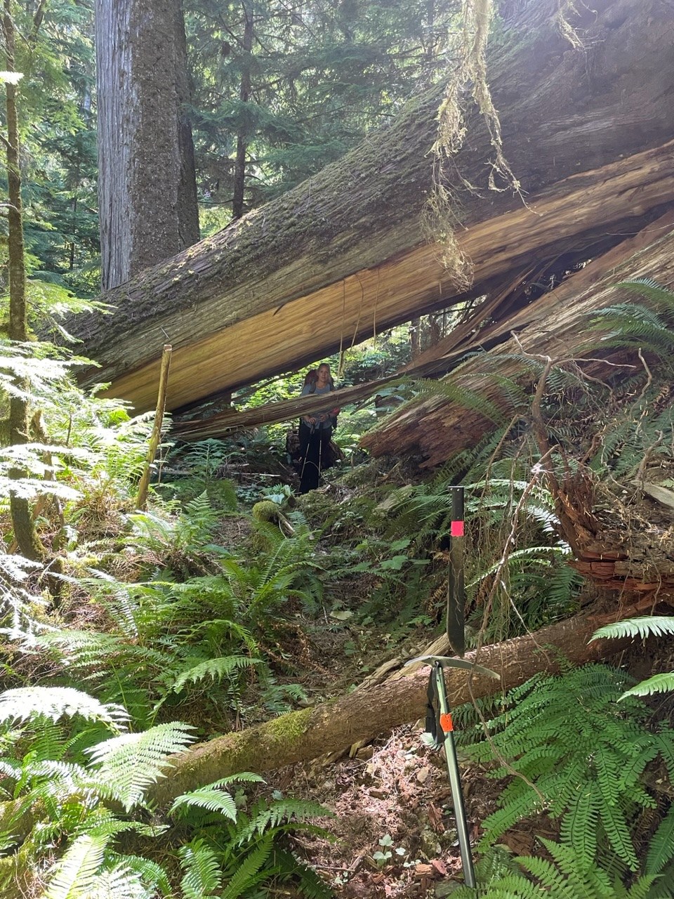
Back in 2015 Miker advised “would not recommended it for a first date.” Well my wife and I are WAY past that stage, but I still wouldn’t recommend it for most couples, or most people for that matter!
The last 5 years have not been kind to this trail. In the 4 miles from Suiattle trailhead to the campsite at the creek draining from Milk Lakes, we counted over 300 down trees to go over, under or around. Sometimes logs on top of other logs, and in places requiring going over one log and under another simultaneously. I admit our down tree count includes some that can be stepped over, but even these required energy that was precious on a trail so wild that just about every step required focus. In addition to the down trees there are many branches, brush, moss, rocks, missing trail sections that slid or uprooted, and streams to ford. And this is only the first 4 miles (first mile is cross country from river crossing to trail).
We got a later start than we had planned so we hiked during the heat of the day, got up to 80 and muggy and buggy.
Still feel like exploring this? Here are the Highlights. River crossing by the Suiattle trailhead is good with 2 parallel logs to choose from spanning the main channel with other logs jammed on both ends tying to the banks. Cross country mile along the south side of Suiattle has followable sections of worn boot path but sometimes you have to deviate around recent blowdown. There are some blue flags in places to guide. There are also still some remnant orange USFS project flags for the proposed reroute. In places the boot path follows the orange then veers away from it. The path goes into the river bed for a short distance then back out. Near the end of the cross country mile you come to where the river bank is high and steeply eroded with a log jam at the base. You can either cross the log jam or skirt around it to the right on the loose rock bank, but whichever you choose, finish traversing the high bank to its east end then exit the channel and the trail is 100 feet south at the slope base. It’s a switchback where the trail turns upriver after briefly running downriver from the old bridge site. You’re now on official trail and only 143 down trees to go. Ford the creek that comes from Rivord Lake or cross on a log 100 feet upstream. Ascend several switchbacks where a few logs were bucked since 2018 and branches lopped. Several switchbacks are blowdown covered requiring short detours. Ford a small stream in a gulley with some difficult footing. Traverse a missing section of trail about 100 yards with fixed rope at upper end to help get back up onto the trail. Finally after about 3 miles the trail turns into Milk Creek drainage (only 65 down trees to go!) and descends slightly through some magnificent old Douglas fir.
The last half mile before the campsite was probably the worst, quite a jackstrawed mess that has expanded in recent years. But there is an intact stringer bridge in there that crosses a small stream in a brushy draw. After the bridge is a section about 100 yards where the trail is invisible, then reappears just before another mostly intact bridge over a small skunk cabbage lined stream. Campsite is right next to the trail on the right, just before a major stream from Milk Lakes. There’s a big snag currently shedding dead branches onto the campsite so we pitched the tent right next to the trail out of the drop zone.
After a peaceful nights sleep, we packed up and did it all over again in reverse.


Comments