August 11th, 2007: Lost Creek Ridge – Lake Byrne
Additional photos: http://www.flickr.com/photos/shahiddurrani/sets/72157601394324506
Miles and miles of lush flowery meadows along a 5,500ft+ ridge, with jaw-dropping views of glaciated peaks and stunning lakes…a supreme hiking experience!
My hiking day began with a 4:45am start from the trailhead. The first half-hour was covered in a bubble of light cast by my flashlight. Slowly, as the light improved, I became aware of being surrounded by semi-open woods. Views were non-existent in the beginning, until I reached the Lost Creek Ridge crest at Bingley Gap. Immediately, I got the first of the jaw-dropping views: glaciated Spring and Pugh Mountains in front, and Sloan and Bedal Peak behind me.
As I started hiking along the ridge, Sloan Peak became ever more impressive. Soon, I was out of the woods and into lush green meadows, carpeted with flowers. Views to the south improved and became more and more expansive: Mount Stuart, Mount Hinman and Mount Daniel were the backdrop for Red Mountain and Sloan and Bedal Peaks.
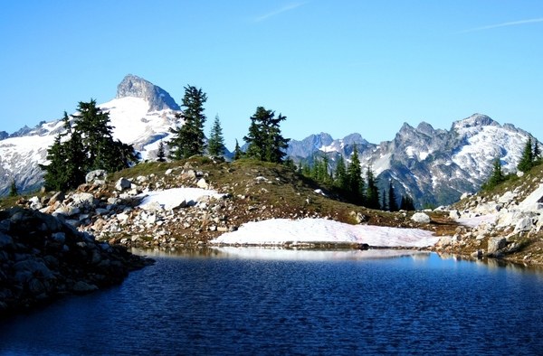
The first of the water stops was the Round Lake overlook. The sun was still quite low so that Round Lake, located in a cold bowl 500ft below me, deep in shadow, looked quite inhospitable. I was not tempted to head down to Round Lake; instead I decided to spend a bit of time trying to locate Sunup Lake. This took a bit of searching, but I was finally successful, and was rewarded with a pretty little tarn in a rocky basin.
Back on the trail, now hiking under a warming sun, I vended my way east through glorious meadows. Sloan Peak kept me company throughout, and Glacier Peak would make an appearance from time to time. Finally, I moved over from the south side of the ridge crest over to the north side. Immediately, Mounts Baker and Shuksan caught the eye. About 400ft below me was a tarn set in yet another lovely basin.
Heading down said 400ft (bypassing the tarn), it was more meadow walking until a short climb to the ridge crest and Hardtack Lake. Views of Glacier Peak were stunning here! Hardtack Lake was lovely: beautiful mossy banks, open meadows, lovely green color and burbling streams leading down to it.
Leaving Hardtack Lake behind, I traversed along the north side of Lost Creek Ridge for a bit, climbed a saddle and into the bowl of Camp Lake. Camp Lake, despite its unglamorous name, was also a stunner: rocky cliffs on one side, meadows on the other, a peaceful outlet stream and a brilliant blue color.
Next up, a short climb up out of the Camp Lake basin, almost like an appetizer for the main course, was the Little Siberia basin: a precious little rocky basin strewn with tiny streamlets from melting snow. This was the highest point of the trip at 6,000ft; soon I crested a saddle and my destination, fabulous Lake Byrne, was right in front, about 450ft below.
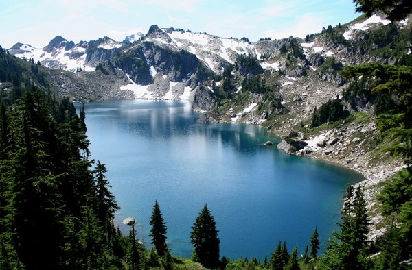
Lake Byrne is absolutely gorgeous! Deep blue waters, rocky cliffs on one side, meadows on the other, and dominating all: Glacier Peak. I had the place to myself and was able to enjoy myself in lonely splendor. Unfortunately, since I still had a long arduous return journey in front of me (12mi, 2,200ft of gain!), the fun was over all too soon as I reluctantly headed back.
Stats:
• Distance (round trip): 24.5mi
• Elevation gain (cumulative): 8,000ft. High point: 6,000ft
• Hiking time: 12hrs.


Comments