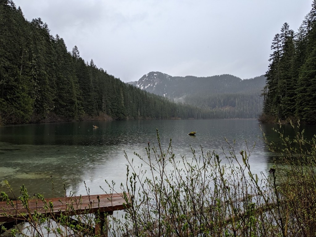

Nestled in a deep basin in the Dark Divide, Blue Lake lies at the headwaters of Blue Creek and offers more than 11 miles of trail for hikers, bikers and equestrians alike to enjoy.
Visitors climb steadily through conifer forests to the crystal waters of a lake in the heart of Bigfoot country. Some believe the lake was formed when a stream was dammed by lava from Blue Lake Volcano, a cinder cone west of the lake.
With history and myths like this surrounding this area, it's no surprise that the trail sees heavy use. Users are dispersed as they near the lake: bikers and equestrians use the Jumpoff Trail and Bishop Ridge to loop around the lake, while hikers can continue in relative quiet on the Blue Lake Trail just past the lake.
The hike is a decent challenge because it's a narrow, steep trail. The terrain is interesting, with waterfalls and its trademark basalt columns. If you like solitude, this is the trail for you.
The trail ascends to the canyon of Blue Lake Creek, sometimes very steeply (stone steps in some stretches provide much-needed help), and then follows it for most of the remainder of the hike.
No overwhelming views, but occasional ones down to the Cispus valley. The canyon is very pretty, rising nearly vertically on the other side of the creek from the trail, with several small waterfalls and interesting formations.
About 1/4 mile before the lake is a junction with Blue Lake Ridge trail 271. (Note: motorized vehicles are permitted on 271.) Some past logging is visible from the trail shortly before the junction. Campsites are available at the lake, which is quite large and very blue.
Blue Lake Creek

-
 Length
- 4.8 miles, roundtrip
-
 Elevation Gain
- 2,100 feet
-
 Highest Point
- 4,000 feet
Although this is a short hike, it's a decent challenge because it's a narrow, steep trail. The terrain is interesting, with waterfalls and its trademark basalt columns. If you like solitude, this is the trail for you.
Continue reading
Hiking Blue Lake Creek

WTA worked here in 2016 and 2015!
Map & Directions
 Trailhead
Before You Go
Parking Pass/Entry Fee
NoneWTA Pro Tip: Save a copy of our directions before you leave! App-based driving directions aren't always accurate and data connections may be unreliable as you drive to the trailhead.
Getting There
From Hwy 12 in Randle, take the junction with signs pointing to Mount St. Helens, cross the Cowlitz River, and take the left fork to Forest Road 23. The turnoff to the Hiker trailhead is at mile 16 on this road, on the left immediately take forest road 171. The road to the trailhead may be narrow and bumpy.


