
Burnt Bridge Creek is named for a small, primitive bridge built over the creek in 1889. As the population expanded, traffic shifted to a larger bridge build to the west in 1895. The little bridge subsequently burnt down giving the creek its name.
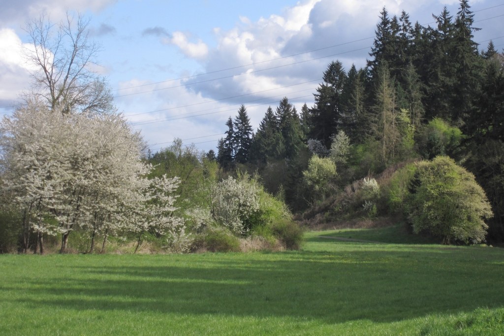
Peaceful is the best way to describe the Stewart Glen portion of the Burnt Bridge Creek Greenway. This hike begins at backwaters on the west end of Stewart Glen and follows the Burnt Bridge Creek upstream though thick woods, grassy bottom lands, and a meadow. You will be immediately immersed in the serenity of nature, making this the perfect break from city life.
Before beginning this hike, take time to enjoy the lake-like backwaters where you may see ducks bobbing or hear frogs croaking. The shared-use paved trail immediately enters a wooded area with a forested slope on the right and views of the creek on the left. You will witness the transition of the creek as it flows downstream through grassy bottomlands to join with the backwaters.
After one mile, the trail breaks into a park-like meadow where you can pause and relish the beauty of the scenery. The trail splits just after entering the meadow. You can go either direction, since the two paths rejoin on the other end of the meadow.
At 1.3 miles, you will come to a small bridge marking the east end of Steward Glen. The bridge is the turnaround for this hike. If you would like to extend your trip, cross NW Alki Road and follow the greenway through a more residential area.
Burnt Bridge Creek - Stewart Glen Section

-
 Length
- 2.6 miles, roundtrip
-
 Elevation Gain
- 548 feet
-
 Highest Point
- 111 feet
Parking Pass/Entry Fee
None
Peaceful is the best way to describe the Stewart Glen portion of the Burnt Bridge Creek Greenway. This hike begins at backwaters on the west end of Stewart Glen and follows the Burnt Bridge Creek upstream though thick woods, grassy bottom lands, and a meadow. You will be immediately immersed in the serenity of nature, making this the perfect break from city life.
Continue reading
Hiking Burnt Bridge Creek - Stewart Glen Section
Map & Directions
 Trailhead
Before You Go
Parking Pass/Entry Fee
NoneWTA Pro Tip: Save a copy of our directions before you leave! App-based driving directions aren't always accurate and data connections may be unreliable as you drive to the trailhead.
Getting There
Take exit 4 off I-5 and drive west on NE 78th Street for 1.7 miles to Fruit Valley Road. Turn left on Fruit Valley Road and drive 0.3 miles to NW Bernie Drive. Although the trailhead is at Bernie Drive and Fruit Valley Road, you will likely need to turn left on Bernie and park along the street on a steep hill.
take transit
This trailhead is accessible by bus! Plan your visit by bus using TOTAGO, or consult the schedule for C-Tran route number 2.


