Trails for everyone, forever

Home Go Hiking Hiking Guide By Pass Trail

By Pass Trail

Issaquah Alps > Cougar Mountain
47.5301, -122.1030 Map & Directions
Length
0.2 miles, one-way
Elevation Gain
50 feet
Highest Point
1,256 feet
Calculated Difficulty About Calculated Difficulty
Easy
Pacific Bleeding Heart, native to the Western US. Photo by CoffeeYeen. Full-size image
  • Dogs allowed on leash
  • Good for kids

Parking Pass/Entry Fee

None
Saved to My Backpack

A short access trail from the Clay Pit Road that connects with the Cave Hole Trail and others to make endless loop options on Cougar Mountain. Continue reading

Rating
4.20 out of 5

(5 votes) Log in to rate

Hiking By Pass Trail

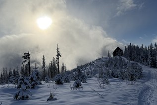
A short access trail from the Clay Pit Road that, along with about 100 feet of Fred's Railroad Trail, connects with the Cave Hole Trail and others to make endless loop options on Cougar Mountain.

Wheelchair Accessibility

This trail is hard-packed dirt and is reasonably free from rocks and roots crossing the trail. It does not have any significant barriers to wheelchairs. It does have some noticeable cross slope, and there is a noticeable grade going up as you head from west to east (towards Clay Pit Road). It is likely accessible to most manual chair users with assistance. If you are headed to Clay Pit Mine, consider connecting this with Cave Hole Trail if you want a mostly accessible route that doesn't feel like just a road the entire way. 

[Accessibility notes provided by Z. K.]

By Pass Trail

Map & Directions

Trailhead
Co-ordinates: 47.5301, -122.1030 Open in Google Maps

Before You Go

See weather forecast

Parking Pass/Entry Fee

None

WTA Pro Tip: Save a copy of our directions before you leave! App-based driving directions aren't always accurate and data connections may be unreliable as you drive to the trailhead.

Getting There

From I-90: Take exit 13 for Lakemont Boulevard. Turn right onto Lakemont Boulevard which eventually becomes Newcastle-Coal Creek Road. Turn left onto Cougar Mountain Way and proceed for about 0.5 mile before turning right onto 166th Way. Follow 166th Way for about 0.75 mile to a yellow gate and a large parking area to the right.

More Hike Details

Trailhead

Issaquah Alps > Cougar Mountain

King County Parks

Guidebooks & Maps

National Geographic Issaquah Alps Mount Si 824

You can improve or add to this guidebook entry!

By Pass Trail

79 Trip Reports

Hiked here recently?

Submit a trip report!
 
Trip Reports