Trails for everyone, forever

Home Go Hiking Hiking Guide Cornwall Park

Alert: On Oct. 1 the federal government began a partial shutdown that will impact National Parks, National Wildlife Refuges and U.S. Forest Service lands in Washington. Here's the latest information we have for hikers and campers


Cornwall Park

Puget Sound and Islands > Bellingham Area
48.7747, -122.4822 Map & Directions
Length
1.5 miles of trails
Elevation Gain
0 feet
Highest Point
78 feet
A gloomy fall day at the park. Photo by Lindsay Leffelman. Full-size image
  • Dogs allowed on leash
  • Fall foliage
  • Good for kids

Parking Pass/Entry Fee

None
Saved to My Backpack

Located in the heart of Bellingham, this transit-accessible pocket of nature in the city has a little something for everyone. Continue reading

Rating
0.00 out of 5

(0 votes) Log in to rate

Hiking Cornwall Park

In 1909, a majority of the park’s current 70 acres were donated by the Cornwall family in honor of industrialist and philanthropist Pierre Barlow Cornwall. In its early years, the park was a popular car camping destination. Though no longer open to overnight visitors, the park is still a popular day-use destination. From trails to playgrounds, and from disc golf to multiple sports courts, there is no shortage of recreation opportunities at Cornwall Park.

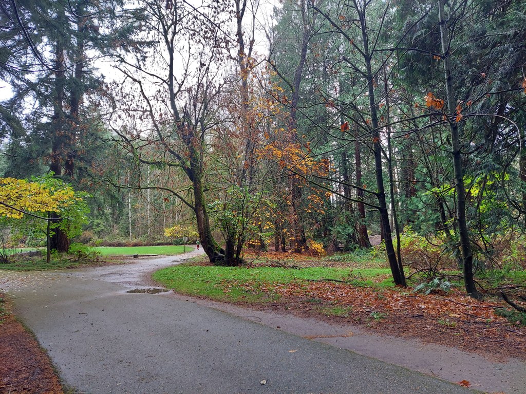
A series of interconnected trails wind their way through the park passing open fields, forested areas and Squalicum Creek.  Most of the trails that encircle the park are paved, wide and wheelchair-friendly. The trails themselves are unnamed and, while there are trail maps posted at a few key locations in the park, the trail junctions are unsigned. Despite the lack of signs, there are plenty of landmarks to keep you oriented. You can choose your own adventure and connect the trails in any way you like, but please take care to stay on the trail to protect the sensitive vegetation.  

Depending on the time of year, the park’s trails are perfect for dodging the winter snow at higher elevations, watching for blooming magnolias in the spring, looking for abundant mushrooms in the fall or escaping the summer heat by cooling off in the shade of the forest canopy. 

Extending your hike

After visiting Cornwall Park, if you’re itching to get more miles under your belt, consider adding on a stop at other nearby parks — Sunset Pond, Squalicum Creek and Elizabeth Park are good options.

Toilet Information

  • Toilet at trailhead

More information about toilets

Hike Description Written by
Lindsay Leffelman, WTA Correspondent

Cornwall Park

Map & Directions

Trailhead
Co-ordinates: 48.7747, -122.4822 Open in Google Maps

Before You Go

See weather forecast

Parking Pass/Entry Fee

None

WTA Pro Tip: Save a copy of our directions before you leave! App-based driving directions aren't always accurate and data connections may be unreliable as you drive to the trailhead.

Getting There

From I-5, take exit 256 (256A if coming from the south). Turn south onto Meridian St (left if coming from the south, right if coming from the north). In 0.6 mile, turn left into the park. 

Take Transit

Take Whatcom Transportation Authority route 15 to Meridian St at Victor St. Walk east down W Victor Street a few hundred feet — a trail heading into the park will be on your left. 

You can also take route 4 to Birchwood Ave at Meridian St. There is an entrance to the park on the south side of the road here. 

More Hike Details

Trailhead

Puget Sound and Islands > Bellingham Area

City of Bellingham

Guidebooks & Maps

https://cob.org/wp-content/uploads/7.0-Cornwall-Park-Map.pdf

You can improve or add to this guidebook entry!

Cornwall Park

0 Trip Reports

Hiked here recently?

Submit a trip report!
 
There aren't any trip reports for this hike yet.
Loading trip reports...