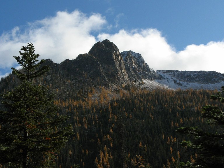

Take this gentle trail to a beautiful alpine lake surrounded by rocky cliffs before heading up some steeper switchbacks to a pass and junction with the iconic Pacific Crest Trail.
The beginning of the trail finds you venturing across Cutthroat Creek, a pretty, clear mountain stream. After the crossing, traverse low on the valley wall, passing several seasonal waterfalls in thin forest. Pass huge lichen-covered granite boulders and look for peek-a-boo views of a rocky ridge to the south.
Keep in mind that while the creek is occasionally audible, it is not near the trail, and much of the runoff is seasonal, so be sure to have plenty of water before you head up. 1.8 miles into the hike is a junction. The left branch consists of rolling terrain for 0.2 miles to Cutthroat Lake, a delightful place to take a short break before heading up to the pass.
If you want to bypass the lake, take the right-hand trail. This begins switchbacking after a short uphill traverse, gaining 1800 feet of elevation in 3.7 miles. But the pass, once reached, is well worth the effort. At the pass, you're straddling Skagit and Okanogan Counties, and the Pacific Crest Trail (PCT) rolls out in front of you to the northeast and southwest.
You may have company in the pass--many day hikers can access Cutthroat Pass using the PCT from the Rainy Pass picnic area. Take in all your surroundings, get some photos, maybe even give some words of encouragement to PCT thru-hikers you may see before heading back down to the trailhead.
Cutthroat Pass via Cutthroat Lake

-
 Length
- 11.4 miles, roundtrip
-
 Elevation Gain
- 2,300 feet
-
 Highest Point
- 6,800 feet
Highway 20 is closed between the Ross Dam trailhead (milepost 134) and Silver Star gate (milepost 171) for the winter season.
Take this gentle trail to a beautiful alpine lake surrounded by rocky cliffs before heading up some steeper switchbacks to a pass and junction with the iconic Pacific Crest Trail.
Continue reading
Hiking Cutthroat Pass via Cutthroat Lake
Map & Directions
 Trailhead
Before You Go
Highway 20 is closed between the Ross Dam trailhead (milepost 134) and Silver Star gate (milepost 171) for the winter season.
Parking Pass/Entry Fee
Northwest Forest PassWTA Pro Tip: Save a copy of our directions before you leave! App-based driving directions aren't always accurate and data connections may be unreliable as you drive to the trailhead.
Getting There
The trailhead for Cutthroat Lake and Pass is just a few miles east of Washington Pass on the North Cascades Highway (Hwy 20). There is a side road clearly marked "Cutthroat Lake Trailhead". Turn onto this road and proceed about a mile, where the road and ends in a small parking lot with a pit toilet.


