Trails for everyone, forever

Home Go Hiking Hiking Guide Daroga State Park

Alert: On Oct. 1 the federal government began a partial shutdown that will impact National Parks, National Wildlife Refuges and U.S. Forest Service lands in Washington. Here's the latest information we have for hikers and campers


Daroga State Park

Central Washington > Wenatchee
47.7122, -120.2076 Map & Directions
Length
2.5 miles of trails
Elevation Gain
50 feet
Highest Point
765 feet

The park is closed during the winter season between Nov 1 and March 31.

The paved trail on a lovely fall day. Photo by Shannon Leader. Full-size image
  • Dogs allowed on leash
  • Good for kids
  • Rivers

Parking Pass/Entry Fee

Discover Pass
Saved to My Backpack

Daroga State Park is a recreational oasis in Central Washington, providing riverside access for a host of outdoor activities. Bring the family for a full day along the Columbia River — everyone is sure to find something that will bring them joy. Continue reading

Rating
0.00 out of 5

(0 votes) Log in to rate

Hiking Daroga State Park

Once the home of the Columbia-Sinkiuse people and then a thriving orchard, Daroga State Park encompasses 127 acres along 1.5 miles of the Columbia River. Adjacent to desert scablands, its 2.5 miles of paved trail connect three campgrounds and a variety of outdoor recreation opportunities. The word Daroga is taken from the names of the brothers who owned the orchard: David, Robert and Grady Auvil.

The trail begins at the third parking lot and main campground, offering expansive views of the Columbia River. Gaze up the Entiat Valley and then across the river for munching mule deer and soaring golden eagles in the protected Entiat Wildlife Area. Drop down past the boat launch and stroll above shallow coves. For those able, the grassy slope descends to the shoreline where one can enjoy a picnic and relax while watching herons scanning for their lunch.  

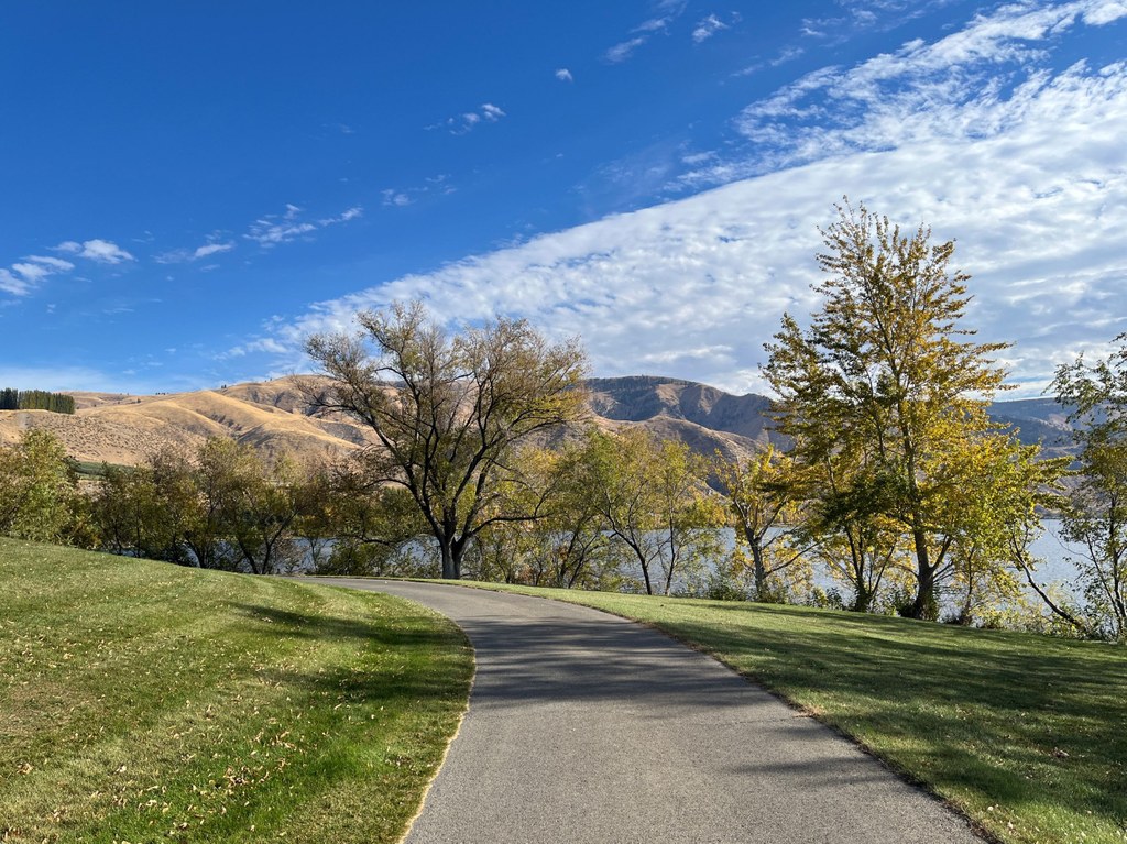
The wide path enters the middle of the park and gently rolls through a combination of deciduous and evergreen trees. Side trails lead to picnic tables and the second parking lot. Passing the playground, the trail meets a promenade above a sheltered, sandy beachfront. A line of benches beckon; sit and admire the rugged slopes of Ribbon and Dick mesas across the river. Resume past sports fields; there is a loop around the play areas and up to the first parking lot.

Continuing south, the trail runs between the Columbia River and a tranquil lagoon with graceful Lombardy poplars buffering the breeze. After crossing the first of two outlets, an “island” with a walk- or boat-in campground and dock will be on the right; there are a few loops between campsites. On the left, the U-shaped lagoon awaits for paddling, swimming or possibly hooking smallmouth bass. The trail crosses the second outlet and winds between private property and an inlet formed by a thin jetty. Now at the group camping area, it’s time to retrace your steps.

WTA Pro Tip: Daroga is also known for both geocaching and metal detecting; you can find information at geocaching.com and the state park provides a metal detecting map on their website. Do not fly kites at Daroga due to the power lines overhead.

Toilet Information

  • Toilet at trailhead

More information about toilets

Hike Description Written by
Shannon Leader, WTA Correspondent

Daroga State Park

Map & Directions

Trailhead
Co-ordinates: 47.7122, -120.2076 Open in Google Maps

Before You Go

The park is closed during the winter season between Nov 1 and March 31.

See weather forecast

Parking Pass/Entry Fee

Discover Pass

WTA Pro Tip: Save a copy of our directions before you leave! App-based driving directions aren't always accurate and data connections may be unreliable as you drive to the trailhead.

Getting There

The park is at 1 N Daroga Park Lane in Orondo on Highway 97, 24 miles north of Wenatchee and 20 miles south of Chelan. 

There are three parking lots along with accessible kitchen shelters, picnic tables and bathrooms throughout. The first parking lot has a gradual 50-foot descent to connect with the main trail, whereas the second and third parking lots provide a level start.

The park is open from 6:30 a.m. to dusk, April 1 to Sept. 30.

More Hike Details

Trailhead

Central Washington > Wenatchee

Chelan Douglas PUD, Washington State Parks

Guidebooks & Maps

https://parks.wa.gov/find-parks/state-parks/daroga-state-park

You can improve or add to this guidebook entry!

Daroga State Park

1 Trip Report

Hiked here recently?

Submit a trip report!
 
Trip Reports