Trails for everyone, forever

Home Go Hiking Hiking Guide Divide Camp

Divide Camp

South Cascades > Mount Adams Area
46.2693, -121.5787 Map & Directions
Length
5.8 miles, roundtrip
Elevation Gain
1,400 feet
Highest Point
6,100 feet
Calculated Difficulty About Calculated Difficulty
Moderate
Gorgeous meadow views of Mount Adams. Photo by JulieRal. Full-size image
  • Dogs allowed on leash
  • Mountain views
  • Old growth
  • Rivers
  • Wildflowers/Meadows

Parking Pass/Entry Fee

None
Saved to My Backpack

The Divide Camp Trail features dense forests, glacial creeks and wildflower-strewn meadows. It also sees less traffic than the nearby Killen Creek Trail – the standard approach to High Camp. Continue reading

Rating
2.17 out of 5

(6 votes) Log in to rate

Hiking Divide Camp

The Divide Camp Trail features dense forests, glacial creeks, and wildflower-strewn meadows. It also sees less traffic than the nearby Killen Creek Trail — the standard approach to High Camp.

Beginning at the boundary of the Mount Adams Wilderness and proceeding southeast towards Mount Adams, this trail ascends moderately from 4700 feet of elevation to 6100 feet. The way takes you through a dense forest, follows Adams Creek and after 2 miles bursts out on an alpine meadow with a view of Mount Adams and the Adams glacier. 

From this view, it's just another 0.9 miles to a junction with the Pacific Crest Trail. From here, you might find a campsites about 0.3 miles off the Divide Camp trail, isolated at the foot of a lava field. Along the trek are wildflowers, glacial moraines, and evidence of wildlife. 

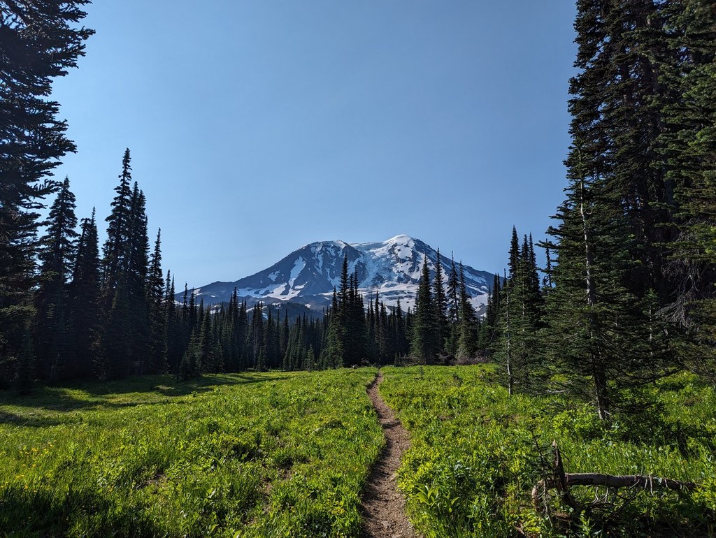
On the way back are views of Mount Rainier and Mount St. Helens. Although a clear day for this hike will give you a lot to see, even an overcast day will not be disappointing in crossing the meadows of wildflowers. Bring plenty of water. The only water source is Adams Creek and it is cloudy with glacial silt that will clog up a filter. Mosquitos are through July but gone by August. 

The trail is a major access point for climbers on the north and western slopes of the mountain. Ambitious hikers can use this as hiking access with the Muddy Meadows Trail 114 or Killen Creek Trail #113 to the north each joined by the Pacific Crest Trail.  Midweek hikes will be less crowded than weekend ones. 

Toilet Information

  • No toilet at trailhead

More information about toilets

WTA worked here in 2013!

Divide Camp

Map & Directions

Trailhead
Co-ordinates: 46.2693, -121.5787 Open in Google Maps

Before You Go

See weather forecast

Parking Pass/Entry Fee

None

WTA Pro Tip: Save a copy of our directions before you leave! App-based driving directions aren't always accurate and data connections may be unreliable as you drive to the trailhead.

Getting There

From Trout Lake, at the Y intersection by the gas station, go right (north) on the Mount Adams Highway. In 1.2 miles, go left on paved Forest Road 23. Continue of FR 23 for 24 miles, crossing over Babyshoe Pass, to a prominent junction. Turn right on FR 2329 signed for Takhlakh Lake and Olallie Lake. Drive 0.8 miles and turn right, staying on FR 2329. In 0.7 mile, reach the access to the Takhlakh Lake Campground. Stay left on FR 2239. Continue another 2 miles to the Divide Camp trailhead (#112) on the right.

From Randle, drive 0.9 mile south on State Route 131 and go left at the Y intersection onto FR 23. Continue 30.1 miles (stay right at the junction with FR 21 at 17.5 miles), then turn left at a sign pointing toward Takhlakh Lake onto FR 2329. Drive 0.8 miles and turn right, staying on FR 2329. In 0.7 mile, reach the access to the Takhlakh Lake Campground. Stay left on FR 2239. Continue another 2 miles to the Divide Camp trailhead (#112) on the right.

More Hike Details

Trailhead

South Cascades > Mount Adams Area

Divide Camp (#112)

Gifford Pinchot National Forest, Mount Adams Ranger District

Guidebooks & Maps

Asars T. Day Hiking Mount Adams and Goat Rocks. Mountaineers Books (2013)

Barstrd F. Hiking Washington’s Mount Adams Country

A Falcon Guide. 2004

Mount Adams Wilderness - Gifford Pinchot National Forest (2005)

Mt. Adams Ranger District - Gifford Pinchot National Forest (2003)

Mount St. Helens & Mount Adams – National Geographic 822 (ca 2012)

Buy the Green Trails Mt Adams No. 367S map

You can improve or add to this guidebook entry!

Divide Camp

38 Trip Reports

Hiked here recently?

Submit a trip report!
 
Loading trip reports...
Trip Reports