

The Tumac plateau is a wonderland of rolling sub-alpine forest broken by wildflower meadows, ponds, and lake after lake. The 14-mile lollipop loop to Dumbbell Lake will take you past seven lakes large enough to have been named along with many smaller ponds and marshes that provide some of the finest elk, trout, and mosquito habitat in the Cascades. Easy trails and abundant scenic camps make wandering the wilds of the William O. Douglas an experience that backpackers old and new can enjoy at a relaxing pace without the knee-wrecking elevation that reaching many of the alpine lakes elsewhere in the state requires.
From the trailhead, hike north on the Pacific Crest Trail climbing a series of switchbacks for 1.1 miles to a junction with the Dark Meadow Trail just inside the William O. Douglas Wilderness boundary. Up to this point, the trail is popular, and you'll have lots of company.
But once you take a right on the Dark Meadow Trail, you'll leave everyone behind. You won't find any meadows on this trail but you will lose 600 feet of elevation before reaching a junction with the Cramer Lake Trail at mile 2.9. Take a left and head north with views of Dog Lake below.
At mile 4.1 you'll need to cross Clear Creek, but any remnants of a bridge no longer remain so you may need to hop across on rocks or a downed log. Crossing in the early spring may be difficult but the stream is usually a trickle by midsummer.
From Clear Creek, climb a sometimes-steep grade through old-growth forest mixed with basalt outcroppings, gaining 800 feet of elevation over the course of two miles to reach Cramer Lake. A side trail will lead you to a well-used camp on its north end. But don't dally for too long; Dumbbell is not far.
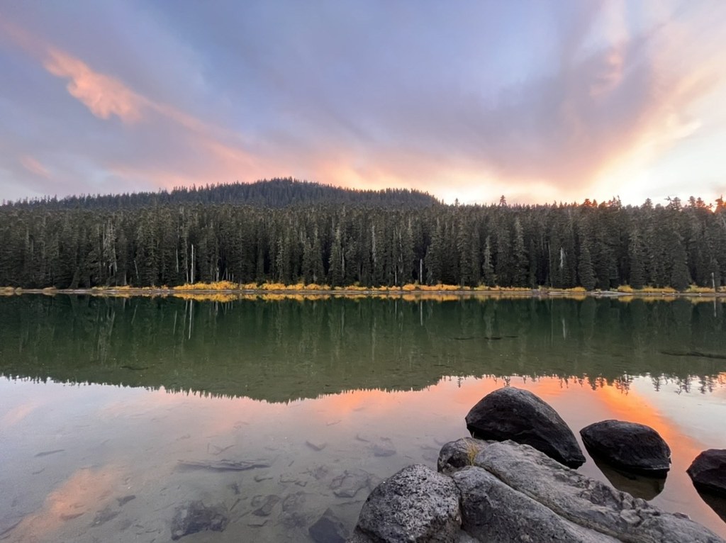
From the Cramer lake junction, skirt the edge of a large meadow then take a left toward Dumbell Lake. At mile 7.2 a path heads down toward well used campsites near the lake. Many user paths exist around the lake, some of which you may explore before arriving at the main one at mile 7.2, and many of which have luxurious spots to contemplate the cold water and enjoy the views of the forested flanks of Cramer Mountain.
To continue the loop, head west on the Dumbbell Lake trail, which meets the PCT in less than half a mile and arrives at marshy Beusch Lake 8 miles from the trailhead. Follow the PCT south, passing Sand Lake at 11 miles and Deer Lake at 11.6 miles. Both of these popular Lakes make excellent pit-stops to enjoy the forest calm before heading downhill on the PCT and arriving back at the trailhead at White Pass Campground at mile 13.5.
WTA Pro Tip: The loop is enjoyable in either direction or as an out-and-back to Dumbbell Lake. Typically the PCT part of the route is more popular but one can also start from the Dog Lake Trail-head near the junction at mile 2.9. Parking at Dog Lake is much more limited (3 spots) and may be full on weekends.

 Trailhead


