

Start out with a half-mile of a flat meadow walk providing a good warm up before entering the woods. Well-signed once this trail splits from the popular Spokane Gulch Trail, you're guided through snowy, usually stable terrain to a summit overlooking the Methow Valley.
Start your hike from the recreation parking lot in Mazama. From here, two options exist. One is to cross the meadow from the southern end of the parking lot heading directly towards the fire lookout on top of Goat Peak (if weather allows you to see it). Methow Trails docents who frequently work the ski trailhead here can provide directions.
The second option is to walk Chechaquo Ranch Road around the large meadow. This road circles the huge meadow and will take you to the woods entrance on the opposite side of the meadow. Look for signs saying SGT on the uphill side of the road. Once in the woods, the trail becomes easy to follow.
Climbing steadily on the SGT you pass many old mining prospects, winding through cliff-bands, in and out of drainages. Keep an eye open for arrows carved into trees 100 years ago when the fire lookout was first built in 1924 by the US Forest Service.
At 3050 feet of elevation, two signs on a tree direct you either towards Sagebrush flats (to the left) or Goat Peak Logging Roads (straight ahead). The Flagg Mountain Snowshoe really begins here (though listed elevation and distance are from the parking lot).
Walking straight up hill from those signs you will see a small square sign with an arrow about 40 yards ahead. Once you locate this there are similar arrows at every turn and generally within sight of each other all the way to the summit. Sometimes steep, though never lasting long, this route winds up old logging roads, stitching together a scenic and generally safe route to the top.
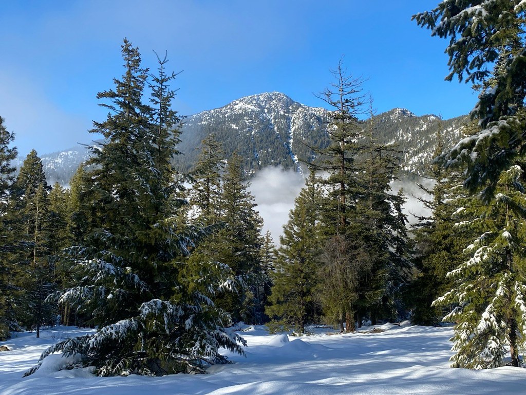
A long ridgeline makes up the final stretch of this hike. Winter’s magic makes for spectacular views, animal tracks here there and everywhere. The summit isn’t the best as it houses radio towers but the views are fantastic. When you’ve retraced your steps back to town your biggest decision will be where to treat yourself with a snack or beverage.
WTA Pro Tip: With a fair amount of elevation gain it is worth noting that trekking poles are highly recommended for contending with the snow. Several stores in Winthrop and Mazama have snowshoe rentals.


