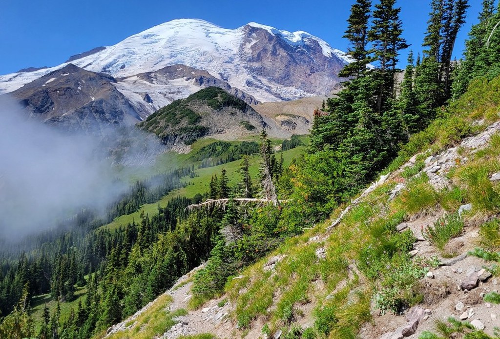

Expansive views of Mount Rainier, up-close views of Emmons Glacier, lakes, and campsites are just a few features of the Glacier Basin Loop's varying landscape.
From the Glacier Basin trailhead in the White River Campground, the 3.25-mile hike up along the Inter Fork of the White River is a breeze thanks to the recent trail restoration done by WTA and the National Park Service.
Along the way, a 0.5-mile side trail heads up Emmons Moraine and offers incredible views of Emmons Glacier, the largest sheet of ice on Rainier, and a milky blue-green glacial lake below. Another mile up, pass the junction with the Burroughs Mountain Trail and continue to the Glacier Basin wilderness camp in a forested glen.
Just beyond the camp, Glacier Basin opens up in all its glory, with wide meadows, a large shimmering tarn, and views up The Mountain of The Wedge and Mount Ruth. You’ll notice a well-worn climber’s trail continuing up to Camps Curtis and Schurman.
For the next leg, double back to the Burroughs Mountain Trail junction and begin a hearty 1,900-foot climb for the next 1.5 miles, first through shady forest, then opening into hillside meadows with stupendous views over the White River Valley and Goat Island Mountain.
As you continue climbing, the meadows dwindle away and soon you’re in rocky alpine tundra with scarce vegetation. Cross a shallow saddle, then mount the final distance amid wide-open alpine plains. The view from 7,400-foot Burroughs Mountain reaches west to the Olympics, north to Glacier Peak and the North Cascades, and southward, where Rainier is all encompassing.
From the summit, take a leisurely stroll down to Frozen Lake and a five-way trail junction. Here, you can head west to Berkeley Park and wilderness camp or north to the Fremont Mountain Lookout.
To continue the loop, head southeast on the Wonderland Trail, descending 1.25 miles into more subalpine meadows ripe with summer wildflowers and seasonal huckleberries. Keep your eyes peeled for black bears.
Sunrise wilderness camp awaits near the shores of Shadow Lake. Completing the loop requires a knee-crunching, 1,900-foot descent in the last 2.5 miles back to White River.
Extend Your Hike: Sure, this hike can be done in a day, but with so much to see, why not slow it down with a camping trip? Three campsites are available along the route: the Glacier Basin wilderness camp (six sites and one group site), Berkeley Park wilderness camp (three sites), and Sunrise wilderness camp (ten sites and two group sites). Take a few days to soak it all in.
Glacier Basin Loop

-
 Length
- 11.5 miles, roundtrip
-
 Elevation Gain
- 3,100 feet
-
 Highest Point
- 7,400 feet
White River Road has closed for the winter season.
Parking Pass/Entry Fee
National Park Pass
Expansive views of Mount Rainier, up-close views of Emmons Glacier, lakes, and campsites are just a few features of the Glacier Basin Loop's varying landscape.
Continue reading
Hiking Glacier Basin Loop

WTA worked here in 2015!
Map & Directions
 Trailhead
Before You Go
White River Road has closed for the winter season.
Parking Pass/Entry Fee
National Park PassWTA Pro Tip: Save a copy of our directions before you leave! App-based driving directions aren't always accurate and data connections may be unreliable as you drive to the trailhead.
Getting There
Learn how to secure your timed-entry permit for Mount Rainier National Park here.
From Enumclaw, head east on Highway 410 for 43 miles to the White River entrance to the park. Turn right onto Sunrise Road and follow it for five miles, then cross the White River and turn left onto the White River Road. Follow the road to its end at the White River Campground. The trailhead is at the upper end of the loop in the campground.


