

Mount St. Helens is an eerie place, considering its dramatic history. The magnificent eruption of 1980 obliterated the top 1,000 feet of the mountain and spewed hot ash and lava across the surrounding valleys, killing everything in its wake. It can be a creepy experience to think about what was lost—and about the Sasquatch sightings that have been recorded here—but take comfort in the fact that the landscape is beginning to heal, with awesome numbers of wildflowers and lush grasses, as life comes back to the scene.
The trail begins in the forest near Ryan Lake and is a steep switch-backing ascent up to the ridge of Goat Mountain, gaining about 1,500 feet within 2.5 miles. This is the most difficult portion of the hike; the remainder of the trail will be a walk on the south-facing side of the ridge.
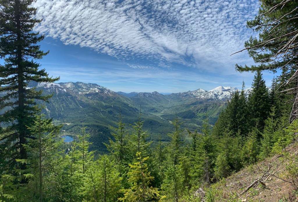
Once you crest the ridge, the majestic views are there to soak up—Mount Rainier dominates your vision to the north, and Mount St. Helens takes your breath away to the south. You’ll also be able to see Mount Adams to the east along the trail, with Mount Hood peeking out in the far distance.
At about 4 miles, as you are heading west on the ridge, you’ll switch over from the southern side to the northern side of the ridge. You can turn around anywhere along here. If you want to continue, you can drop down to Deadman's Lake.
There is plenty to see that doesn’t require the additional leg to the lake, however; looking north there are many lakelets that oftentimes have elk gathered around them. You can also take in the intense demarcation between the blast zone and the unaffected lands, and ponder what it must have been like to be here during that event.
WTA Pro Tip: Road access can be an issue here. Check with the Gifford Pinchot National Forest to see how the roads in this area are before you head here.

 Trailhead


