Trails for everyone, forever

Home Go Hiking Hiking Guide Gobblers Knob
link

Gobblers Knob

Mount Rainier Area > SW - Longmire/Paradise
46.7790, -121.8844 Map & Directions
Length
11.0 miles, roundtrip
Elevation Gain
2,565 feet
Highest Point
5,485 feet
Calculated Difficulty About Calculated Difficulty
Hard
Photo by tookthescenicroute. Full-size image
  • Wildflowers/Meadows
  • Ridges/passes
  • Dogs not allowed
  • Established campsites
  • Mountain views
  • Old growth
  • Lakes

Parking Pass/Entry Fee

National Park Pass

A clear, sparkling lake, up-close views of Mount Rainier, and a historic fire lookout await you on the Gobblers Knob Trail. This route is an eastern approach to the lookout via Westside Road. Continue reading

Rating
3.53 out of 5

(15 votes) Log in to rate

Hiking Gobblers Knob

A clear, sparkling lake, up-close views of Mount Rainier, and a historic fire lookout await you on the Gobblers Knob Trail. This route is an eastern approach to the lookout via Westside Road.

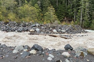
From the Westside Road closure, sling on your pack and continue up the road on foot for 3.8 miles, first along rushing Tahoma Creek, then into forest for a moderate climb to Round Pass and the Lake George trailhead.

The next 0.75 mile climbs 500 feet to the Lake George basin. For anglers, the fishing at Lake George is reported to be exceptional, and licenses are not required within the national park.

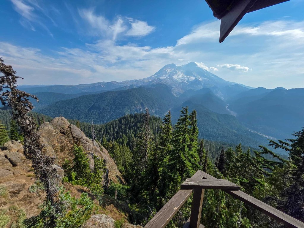
Past the northern tip of Lake George, continue on to Gobblers Knob, a moderate 800-foot climb in just under a mile. At the Goat Lake junction, bear right and traipse through meadows brimming with seasonal lupine, magenta paintbrush, and Columbia lily to the fire lookout and a view that will knock your SmartWools off—Adams, Hood, and St. Helens to the south and east, the Olympics to the west, Lake George below, and Rainier looming dead ahead with front-row views of the Sunset Amphitheater and Tahoma Glacier.

Extend Your Hike: Camp at Lake George for an intro to backpacking or an easy weekend getaway within a mile of one of Washington’s premier viewpoints. If the Lake George permits have all been snatched up, take the Goat Lake Trail (at the saddle junction en route to Gobbler’s Knob) 1 mile down into the Glacier View Wilderness for less-crowded camping at Goat Lake.

WTA worked here in 2021!

Hike Description Written by
Eli Boschetto, WTA Community

Gobblers Knob

Map & Directions

Trailhead
Co-ordinates: 46.7790, -121.8844 Open in Google Maps

Before You Go

See weather forecast

Parking Pass/Entry Fee

National Park Pass

WTA Pro Tip: Save a copy of our directions before you leave! App-based driving directions aren't always accurate and data connections may be unreliable as you drive to the trailhead.

Getting There

From Elbe, head east on State Route 706 for about 14 miles to the Nisqually Entrance to Mount Rainier National Park. About 0.9 miles past the entrance, turn left onto unsigned Westside Road and continue to its closure 3.2 miles up.

More Hike Details

Trailhead

Mount Rainier Area > SW - Longmire/Paradise

Gifford Pinchot National Forest, Cowlitz Valley Ranger District

Guidebooks & Maps

Day Hiking: Mt. Rainier National Park Trails (Nelson & Bauer - Mountaineers Books)

Green Trails Mount Rainier West No. 269

You can improve or add to this guidebook entry

Gobblers Knob

190 Trip Reports

Hiked here recently?

Submit a trip report!
 
Trip Reports