
This area receives less than 20 inches of rain a year in the rainshadow, so the trail dries out fast at the end of winter. By late March, it is usually snow-free, making this a nice early season hike when other places are snowed or soaked in. The trail starts unmarked at the Lower Dungeness Trailhead.
At the small lot's back-left side, look for a yellow gate with a white "Road Closed" sign. Go past the gate onto a well-groomed, nice wide trail. From here, for the next 7.0 miles, you will be in earshot of the river. After a half-mile on the old logging road, come to an old concrete bridge spanning the river below.
The bridge makes a convenient way to cross the river for horses, bikers, and hikers. After the bridge comes to a junction, where you go right. A left would take you down the Gold Creek extension trail, which is very unmaintained and has lots of washouts and landslides, and not very enjoyable. Instead, go right and hike a true trail rather than an old road.
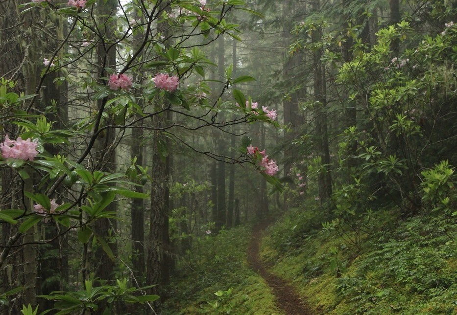
The trail then comes to nice campsites next to Gold Creek. The whole camp has room for plenty of tents and reportedly there is a historic shelter nearby in the area. Cross Gold Creek on a trusty log bridge and make your way uphill as the trail climbs fast above the ravine. Take plenty of breaks to catch your breath. After a mile, the grade eases a little.
After a little more than two miles, come to Sleepy Hollow Creek tucked up in a narrow, shaded ravine. Take a break rest for a few minutes for the trail will get steep. Cross the clear creek on another bridge and continue steeply uphill. About a mile past the creek, comes a junction with the Sleepy Hollow Trail. Head toward the Tubal Cain Mine trail.
From here you will be offered views for a few more miles. Peer down into the Dungeness Valley 1,000 feet below. Or look across the valley to the snow-capped Tyler Peak high above. In a few more miles comes the Tubal Cain Mine Trail. You can keep hiking to the mine to make a 19-mile roundtrip outing.
Gold Creek

-
 Length
- 14.0 miles, roundtrip
-
 Elevation Gain
- 3,500 feet
-
 Highest Point
- 3,250 feet
Parking Pass/Entry Fee
Northwest Forest Pass
Located in the Dungeness River recreational area, this hidden gem provides miles of pleasant hiking, and the scenery is delightful the whole way. And with nearly 15 miles of steep hiking, this also makes a great training hike as well.
Continue reading
Hiking Gold Creek

WTA worked here in 2021, 2005, 2004 and 2003!
Map & Directions
 Trailhead
Before You Go
Parking Pass/Entry Fee
Northwest Forest PassWTA Pro Tip: Save a copy of our directions before you leave! App-based driving directions aren't always accurate and data connections may be unreliable as you drive to the trailhead.
Getting There
Note: Forest Service Road 2880 is steep and not navigable for trailers. The road that provides access to the trailhead has no trailer turn-around and no trailhead parking due to slide damage.
From Sequim
Travel east on Highway 101 and turn south onto Palo Alto Road. Follow it Forest Service Road 2880 (a quarter-mile mile beyond the 28 Road). Turn right onto steep and narrow Forest Service Road 2880 and drive it for 2 miles. Then stay to the left onto Road 2870 and proceed 2.4 miles. Turn left onto the 2870-230 spur and drive 1.6 miles to the trailhead.
From Quilcene
Take Highway 101 north for 25.7 miles, then turn south onto Louella Road. Go 1 mile, then turn left onto Palo Alto and follow it to FR 2880. Turn right onto steep and narrow Forest Service Road 2880 (marked with a wooden sign) and drive it for 2 miles. Then stay to the left onto Road 2870 and proceed 2.4 miles. Turn left onto the 2870-230 spur and drive 1.6 miles to the trailhead.
For trailers: Drive Highway 101 to the Taylor Cutoff Road (2.5 miles west of Sequim) Turn south onto Taylor Cutoff Road, and drive 2.7 miles to Lost Mountain Road, then continue 2.5 miles before turning left onto Forest Service Road 2870. Follow this road 9.5 miles to the 2870-230 spur, turn left and travel 1.6 miles to trailhead.
There is a horse trailer dock at the trailhead.


