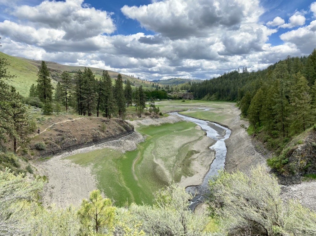

The big drawdown of Lake Roosevelt in the late winter or early spring is the best times to visit Hawk Creek. The low water levels at this time allow hikers to explore the beaches of Hawk Creek just as it was 10,000 years ago. Hikers probably won’t make it to the Columbia confluence, but it is possible to get close enough to see it.
Even if you can't make it in the winter time, there are plenty of upland hikes that are possible when the water levels are high. From these areas, you'll enjoy views of spectacular pre- and post-Pleistocene landforms, including glacial terraces at several levels, Missoula Flood remnants, basalt escarpments, even pillow basalts over 5 million years old!
To explore Hawk Creek on a low water level day, follow a fisherman’s trail west until you see an old road and continue on that track. If the water levels are low, parallel Hawk Creek on the trail and head down the fisherman’s trail over the bank at first opportunity to reach a sandy beach. You can continue for at least a mile if the conditions are right. When the beach disappears, you’ll come across a steep game trail leading up the slope. Continue walking upslope until you bisect an old road and follow that north. When you reach the upper terrace near a rock shelter, you’ll be about 500 feet above Hawk Creek. Head back east and downhill along the terraces and trails until you reach the two track trail and continue back to the parking lot.
Lake Roosevelt National Recreation Area - Hawk Creek

-
 Length
- 4.5 miles, roundtrip
-
 Elevation Gain
- 900 feet
Visit Hawk Creek in the winter to amble along its shoreline, or in the summertime for vistas of incredible geologic landmarks.
Continue reading
Hiking Lake Roosevelt National Recreation Area - Hawk Creek
Map & Directions
 Trailhead
Before You Go
Parking Pass/Entry Fee
NoneWTA Pro Tip: Save a copy of our directions before you leave! App-based driving directions aren't always accurate and data connections may be unreliable as you drive to the trailhead.
Getting There
From Spokane, drive west on I-90 and take exit 277 to US Route 2. Drive west 48 miles on Route 2 to the Telford Rest Stop (after Davenport), and take the next right turn off Route 2 (Telford Road). Drive north on Telford road about 4.5 miles to the intersection with Miles Creston Road and turn right (heading east then north). Follow Miles Creston road for 6.5 miles and look for the Hawk Creek Campground sign on the left. Turn left (west) and drive 1 mile to the campground, and continue all the way to the kiosk/outhouse/parking area. The trail takes off next to the kiosk sign.


