Trails for everyone, forever

Home Go Hiking Hiking Guide Larry Scott Trail

Alert: On Oct. 1 the federal government began a partial shutdown that will impact National Parks, National Wildlife Refuges and U.S. Forest Service lands in Washington. Here's the latest information we have for hikers and campers


Larry Scott Trail

Olympic Peninsula > Northern Coast
48.1057, -122.7811 Map & Directions
Length
7.3 miles, one-way
Elevation Gain
342 feet
Highest Point
270 feet
Calculated Difficulty About Calculated Difficulty
Moderate
A gloomy day on trail. Photo by Kimberly Huntress Inskeep. Full-size image
  • Coast
  • Dogs allowed on leash
  • Good for kids

Parking Pass/Entry Fee

None
Saved to My Backpack

Enjoy a gentle amble through forest — with a dash of ravine, wetland and pasture — and on to sweeping views of Port Townsend Bay as this multi-use trail gently eases hikers, cyclists and equestrians down to the waterfront. Continue reading

Rating
5.00 out of 5

Hiking Larry Scott Trail

Opened in 1998, the trail is part of the Pacific Northwest Trail and is the easternmost — and oldest — section of the Olympic Discovery Trail (ODT). It commemorates Larry Scott, the conservation steward and co-founder of the Peninsula Trails Coalition who championed the development of the ODT. 

From the Milo Curry trailhead, the trail rises gently from the clearing, and after passing some private properties, a ravine descends on the left, a wetland on the right. Ravens and pileated woodpeckers can sometimes be heard. Some domestic animals can be spotted, including many horses (as a sign along the trail warns, don’t feed them fingers — or anything else) in pastures along the trail. Mixed forest and madrona punctuate the pastures, as do the signs of the nearby urban world when the trail briefly runs alongside SR 20. 

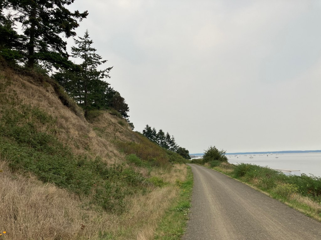
Around mile 3, cross under SR 20 near Jacob Miller Road, where the trail becomes asphalt for a bit before returning you to the forest. In another mile or so, the paper mill on the right signals that you are approaching the waterfront (on some days, the mill’s telltale aroma will greet you before you see it). Shortly, leave the heavy industry behind as the waterfront emerges on the horizon ahead. Check out a helpful pictorial guide to both native and invasive species posted near the western trailhead, courtesy of the Washington Native Plant Society.

All trailheads — Port Townsend waterfront, Cape George and Milo Curry — have restrooms. Bring sufficient water as there are no sources on the trail.

Toilet Information

  • Toilet at trailhead

More information about toilets

Wheelchair Accessibility

The trail is hard-packed and about 10 feet wide in most places. Wheelchair users should know that grades in excess of 5% run for several hundred feet near the 2- and 4-mile markers. The trail crosses a few low-traffic roads, so no long waits or mad dashes are required, with generally good, consistent signage.

Hike Description Written by
K. Huntress Inskeep, WTA Correspondent

Larry Scott Trail

Map & Directions

Trailhead
Co-ordinates: 48.1057, -122.7811 Open in Google Maps

Before You Go

See weather forecast

Parking Pass/Entry Fee

None

WTA Pro Tip: Save a copy of our directions before you leave! App-based driving directions aren't always accurate and data connections may be unreliable as you drive to the trailhead.

Getting There

DRIVING DIRECTIONS FOR PORT TOWNSEND TRAILHEAD

From the Port Townsend ferry dock, head west on Water St. for 1 mile as it becomes Sims Way. Turn left onto Haines Place and drive straight to the water where there is parking. 

DRIVING DIRECTIONS FOR FOUR CORNERS TRAILHEAD

From the Hood Canal Bridge, head northwest on WA-104 for about 6 miles. At the traffic circle, take the right to start on WA-19. Continue for 12 miles. Turn left onto Four Corners Road. Continue for 1.3 miles. The road turns into S Discovery Road when you cross Highway 20. Continue for another 0.3 mile. Take the right here, and the trailhead will be on your left shortly. Restroom available. 

TAKE TRANSIT

Jefferson Transit runs Monday through Saturday and is fare-free.  

Milo Curry Trailhead: Routes 1, 6A, 6B, 7, 8 and 14 stop at Four Corners Park & Ride, a 0.5-mile walk from this trailhead, permitting transit access, or making it easy to hike into town and return to your car via transit. 

Or start from the Port Townsend trailhead and take transit back from Four Corners as the above routes all stop at Haines Place Park and Ride near Safeway, a short walk from the trailhead. 

Jefferson Transit Route 14/Kingston Express runs from the Kingston WSDOT and Kitsap Fast Ferry terminal and includes a stop at Four Corners Park and Ride near the trailhead. 

From Seattle, M-F: Kingston Fast Ferry to Route 14 / Kingston Express

From Edmonds, M-Sat: Edmonds - Kingston Ferry to Route 14 / Kingston Express.

From Kitsap County, North Viking Park and Ride, M-Sat: Jefferson Transit Route 7.

More Hike Details

Trailhead

Olympic Peninsula > Northern Coast

Jefferson County

Guidebooks & Maps

https://www.co.jefferson.wa.us/DocumentCenter/View/951/Larry-Scott-Trail-PDF?bidId=

You can improve or add to this guidebook entry!

Larry Scott Trail

6 Trip Reports

Hiked here recently?

Submit a trip report!
 
Trip Reports