
This infrequently visited trail is the perfect hike early in the season, because the snow melts off the south-facing flanks of the peak early. If you miss the springtime, save it for fall, because the deciduous trees that line the path make it ideal for a shot of fall color. Enjoy a moderately graded that leads you to a summit that boasts views of Rainier and the White River valley.
Follow the White River Trail south along the highway to find the trailhead for the Ranger Creek Trail. Start here, and climb gradually through imposing old-growth forest, passing trees laden with moss. The abundance of life surrounding you is humbling.
Keep an eye out for mobile life, too! Lots of different critters make their home here, though they can be quick and hard to catch a glimpse of. Look up for squirrels and birds flitting through the canopy, and look down for other creatures hunkered down in the underbrush.
Continue climbing through the valley for a little more than two miles, until a sharp turn in the trail takes you away from a fork of Ranger Creek. Head up the sides of the mountain using several long, winding switchbacks, until you arrive at the "summit" -- six miles from the trailhead.
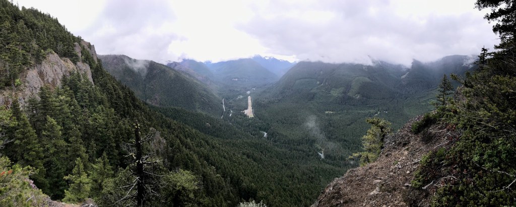
The trail skirts the true summit of Little Ranger Peak, but views from the trail are nearly as good as those from the highest point on the peak. Take a load off and have lunch, taking in the views of Rainier and the peaks of the White River valley before heading back the way you came.
WTA Pro Tip: If you've arranged a shuttle ahead of time, it is possible to take Palisades Trail down seven miles to Highway 410 and drive back to your car. Or do a key swap with another group! The Palisades Trail goes by the stream that feeds Snoquera Falls, and down a moderate grade to the highway.
Little Ranger Peak via Ranger Creek

-
 Length
- 12.0 miles, roundtrip
-
 Elevation Gain
- 2,500 feet
-
 Highest Point
- 5,010 feet
This infrequently visited trail is the perfect hike early in the season, because the snow melts off the south-facing flanks of the peak early. If you miss the springtime, save it for fall, because the deciduous trees that line the path make it ideal for a shot of fall color. Enjoy a moderately graded that leads you to a summit that boasts views of Rainier and the White River valley from the summit.
Continue reading
Hiking Little Ranger Peak via Ranger Creek

WTA worked here in 2001, 1999 and 1998!
Little Ranger Peak via Ranger Creek
Map & Directions
 Trailhead
Before You Go
Parking Pass/Entry Fee
Northwest Forest PassWTA Pro Tip: Save a copy of our directions before you leave! App-based driving directions aren't always accurate and data connections may be unreliable as you drive to the trailhead.


