

Hike trails that form a loop in the Anacortes Community Forest Lands (ACFL). If you have already been to Mount Erie and to Sugarloaf, this hike will take you to one (or optionally to both) of the other two named high points in the ACFL. These are Little Round Top and Sugar Cube. As a bonus, you also will visit a great viewpoint.
Because the ACFL has a complex network of trails, a map really is essential. You can find an excellent map: "Principal Trails of the ACFL (Whistle Lake Area)," at Anacortes bookstores and other businesses, or at City Hall and the Visitor’s Information Center (it's also available as a PDF).
From the trailhead, head south on the obvious trail and almost immediately merge with Trail 300. Take the ongoing (left) branch of Trail 300 (the right branch will be your return route.) Follow the trail, mostly uphill, for about 0.8 miles, passing junctions with Trails 27, 303 and 232. The next trail junction will be with Trail 231.
If you are extending your hike to Sugar Cube (see below) then turn left onto Trail 231. Otherwise, continue on Trail 300 for another 0.13 miles, then turn right on Trail 302. Climb steadily for 0.2 miles and reach the small, grassy, rounded "summit" of Little Round Top. It's your high point for today at 915 feet, and a pleasant stopping point. There is no view here, but you will have your view very soon.
Continue north on Trail 302 an additional 0.15 miles, then turn left on Trail 305. In 0.07 miles, pass a junction with Trail 310 and continue on Trail 305 for another 0.1 miles, where you will turn right on Trail 306. This trail drops a bit and then leads to a viewpoint in about 0.1 mile.
There are outstanding views here, weather permitting. But watch your step! There is no safety railing at the viewpoint, and the terrain (some would say "cliff") drops off steeply here. The Olympic Mountains, parts of San Juan Island, and hints of Vancouver Island are visible in the distance. Lopez and Decatur Islands are much closer. And there are a few smaller islands and a lot of open water. The rounded form of Sugarloaf is obvious, a half-mile to the south and about 200 feet higher than the viewpoint.
To complete the loop, continue on Trail 306 another 0.1 miles, then turn right on Trail 307. In 0.15 miles, that trail ends in a T-junction with Trail 310, where you will turn right. In about 250 feet, turn left on Trail 319. This trail initially descends what looks like a V-shaped canyon, although there is no regular stream flowing at the bottom.
In about 0.1 miles, turn left on Trail 302. Continue north on Trail 302, passing junctions with Trails 311 and 318. When you reach a junction with Trail 315 you have an option. Trails 302 and 315 come back together in 0.08 miles, so you can take either one. If you do this hike more than once you can explore them both.
Trail 302 ends at a T-junction with Trail 304 where you will turn right. Follow Trail 304 for 0.1 mi, then head right on Trail 300. It will return you to your trailhead. This route may sound complicated, and it is. This illustrates why a map is absolutely essential. Fortunately, almost all trail junctions are clearly signed with the trail numbers.
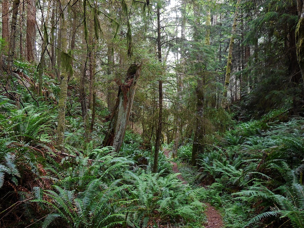
As you do your hike, note the great variety of forest trees, both deciduous and evergreen, some quite large. And note the variety of ferns and small plants.
About the Area
In April and May, many spring wildflowers appear. If you are a flower fancier you might easily count 20 different species. To mention just a few: coralroot, paintbrush, Siberian miner's lettuce, buttercups, stonecrop, foamflower, salal, false lily of the valley and orange honeysuckle. There also are a few invasive plants such as Himalayan blackberry and Robert's geranium, aka "herb Robert."
Along the way you will see occasional small birds, and hear the twittering of others that manage to remain out of sight. You are likely to hear the calls of ravens, although they often sound far off. Squirrel sightings are common and, particularly in spring, you might see a garter snake along the trail.
The trails are open all year, and generally are in good condition except for an occasional seasonal muddy section or blowdown. Sometimes nettles or berry bushes lean in over the trail so be alert for these pricklers. In late spring and early summer you might be bothered by a few bugs, so it's good to carry repellant.
These trails in the ACFL are open to hikers, equestrians, and non-motorized mountain bikers. If you are hiking on a good-weather weekend in spring or summer you might encounter a few of these folks. But if you are hiking on a week day you might have these trails all to yourself.
Extending your hike
The remaining ACFL high point, Sugar Cube, is not cubical. And for any possible sweetness, you will have to provide your own. The name likely was intended to suggest kinship to the larger Sugarloaf, about 0.7 miles to the west and 150 feet higher.
A side trip to Sugar Cube will add about 1.2 miles to your round trip, with an additional cumulative elevation gain of about 250 feet. But don't expect that 250 feet to be a uniform grade. The trail has a bewildering series of short (and not so short) ups and downs, some of them rather steep. This does add interest to the hike, as does the number of massive rock outcrops along the way.
From Trail 300, follow Trail 231 for 0.4 miles, passing a junction with Trail 232 along the way. At a low point, Trail 231 joins Trail 202. Take the right branch here and follow Trail 202 to the Sugar Cube high point.
Sugar Cube has no summit cairn. Not even a survey marker. You will know you have reached the top when there seems to be no higher ground immediately ahead of you, and when the trail begins to head steadily downhill.
While the Sugar Cube trail is interesting, you won't find much of a summit view. The best you can hope for is a hint of an outline of Mount Erie, about 0.75 miles to the southwest, seen through the trees.
Trail 202 does continue on, dropping steeply and losing some 450 feet before reaching trails along the shore of Whistle Lake. This could be an option, although the Whistle Lake trails are more easily reached from the Whistle Lake parking lot. (Check your map.)
When you are satisfied you have reached the Sugar Cube high point (elevation about 870 feet), and have taken a short break, just turn around and head back to Trail 300 where you will turn left and continue on to Little Round Top, as described above.
 Trailhead


