

The multi-use Martin Creek Trail goes between the Eagle Lakes Trail and the Foggy Dew Creek Trail, providing access to the short side trail to Martin Lakes, the trail to Cooney Lake, and the semi-abandoned Foggy Dew Ridge trail. For almost its entire length, it is in the forest with a few peek-a-boo views of the valley or peaks. It does have one lengthy section across a beautiful, steep meadow.
This trail is popular with all types of users. Equestrians use it to access Martin and Cooney Lakes, while mountain bikes use it to do the Angels Staircase Loop. Hikers, on the other hand, typically go the opposite direction, calling it the Sawtooth Lakes Loop (aka Golden Lakes Loop). Motorcycles use this as part of a thru- trip from Foggy Dew Creek to South Navarre or a loop using USFS roads.
Since the trail can be hiked in either direction, the description will start at the Eagle Lakes Trail junction (5590 feet of elevation) and go to the Foggy Dew Creek trail junction at 6040 feet.
The trail starts by descending 350 feet to Eagle Creek at 0.9 mile, which is a ford/rock hop. Eagle Creek used to have a bridge, but its remnants are under the trees on the southeast side of the creek. As of 2017, the other major creeks all have bridges.
After Eagle Creek, the trail starts the climb toward the Martin Lakes Trail junction, initially by using a few switchbacks followed by a long climbing traverse, and then ducking below a large rockslide/avalanche chute. At 2.7 miles is a small campsite (5870 feet) with water available in Martin Creek about 100 yards downhill.
The trail continues to climb with a couple of long switchbacks just before the Martin Lakes trail junction. The first lake is 0.6 mile away and has many campsites near it, and the upper lake. Motorcycles are prohibited on the Martin Lakes Trail.
After the junction, the trail descends 80 feet to cross Martin Creek on a bridge and traverse below a large rock face on the western arm of Martin Peak. The trail continues with tight switchbacks, a traverse, and then more lazy switchbacks as it climbs toward tree line.
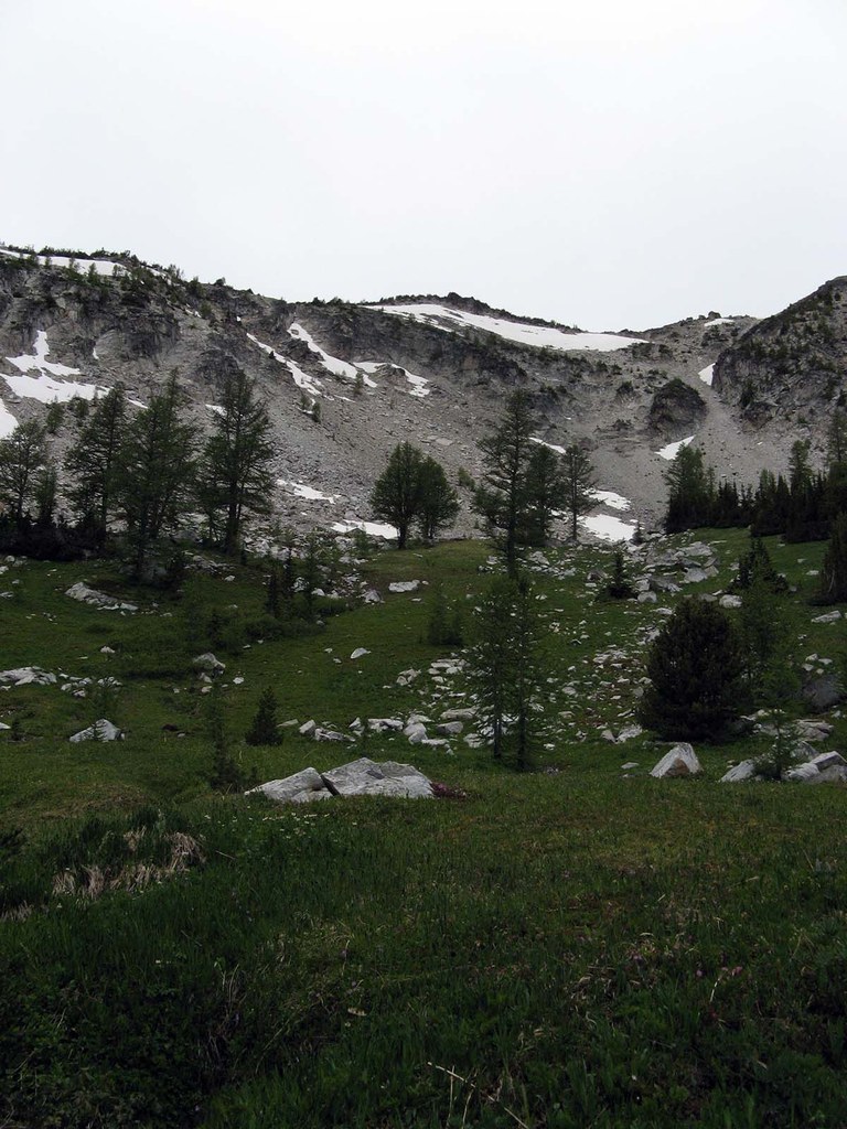
The trail enters a large, steep meadow at 6 miles with a camp at the edge of the larch forest on the southern side (7180 feet). This area has the most flowers along the trail in the early summer and is bounded by a golden larch forest in late fall.
After a short climbing traverse through the larch, the high point is reached, followed by a short descent to the Cooney Lake Trail junction at 6.3 miles and 7240 feet of elevation. Popular Cooney Lake is 0.2 miles away and has many campsites, including two horse camps. Motorcycles are prohibited on the Cooney Lake Trail.
After the junction, the trail starts its descent into the Foggy Dew Creek valley. At 6.5 miles is an unmarked, easily missed junction with the semi-abandoned Foggy Dew Ridge Trail. During the descent there are a few areas of significant erosion and the trail has been re-routed around the worst of it.
After passing a small tarn at 8.1 miles (6320 feet), the trail reaches the Foggy Dew Creek trails (Section 1 and Section 2) at a well marked junction at 6040 feet of elevation. To the east is a 4.9 mile descent to the Foggy Dew Creek Trailhead. To the west is a steep, one-mile climb into the start of beautiful Merchant Basin.
** Note: As of 2017, none of the government maps correctly depict this trail. Over the years, it has been re-routed to keep the gradient low and reduce trail erosion by users. As such, it is currently in very good condition for most of its length.
One reason the trail is in such good shape is thanks to the motorcycle club. Trail users can enjoy a straightforward hike partly thanks to the annual maintenance done by the motorcycle club in this area for at the past 30 years.

 Trailhead


