Trails for everyone, forever

Home Go Hiking Hiking Guide Maxwell Lake

Maxwell Lake

Southwest Washington > Columbia River Gorge - OR
45.2582, -117.3843 Map & Directions
Length
7.6 miles, roundtrip
Elevation Gain
2,419 feet
Highest Point
7,835 feet
Calculated Difficulty About Calculated Difficulty
Hard
The glittering lake on a sunny day. Photo by Austin Smith. Full-size image
Saved to My Backpack

Here is a little largely-forgotten alpine gem nestled in amongst white granite and grizzled pine trees. Continue reading

Rating
0.00 out of 5

(0 votes) Log in to rate

Hiking Maxwell Lake

This trail dead-ends at the lake making for fewer backpackers or horsemen traversing through. Initially, the trail crosses the Lostine River and cuts long, stock-friendly switchbacks making for some easy-going hiking. 

The lush forest is cut periodically by the lake’s outlet creek. Flowers are abundant as is surprisingly shade, a welcome commodity on a hot day. The packstock-worthy switchbacks seemingly end abruptly at 7,000 feet, as though the trail foreman changed their mind and gave the order to "just build the trail as fast as you can." The trail ascends another 800 feet to a cool little pass above your destination. 

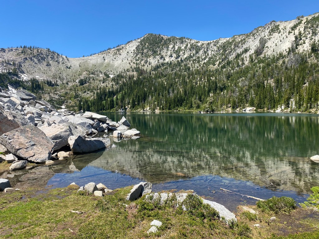
Exiting on the southwest side of the pass, the terrain opens up into a verdant bowl of flowers, miniature cascades and bright white granite. High walls ring the lake, dappled with snow, and traversed by resident mountain goats. Maxwell Lake is a few hundred feet below, but don’t rush — soak in the alpine nectar. 

A smaller lake has a fisherman’s trail to it, if you’re inclined. Please be conscientious when choosing your campsite, to minimize disturbing soil and plants. Goats do live here, so practice appropriate bathroom habits.

Hike Description Written by
Austin Smith, WTA Correspondent

Maxwell Lake

Map & Directions

Trailhead
Co-ordinates: 45.2582, -117.3843 Open in Google Maps

Before You Go

See weather forecast

WTA Pro Tip: Save a copy of our directions before you leave! App-based driving directions aren't always accurate and data connections may be unreliable as you drive to the trailhead.

Getting There

From Enterprise, Oregon, travel west on Highway 82 for 10 miles to Lostine, Oregon. In Lostine, turn left at Lostine River Road and go 7 miles. The Lostine River Road turns into Forest Road 8210 at Forest Boundary. Continue 10.5 miles on Forest Road 8210. The campground entrance is on the right side of the road. The trailhead departs from the north end of the campground.

More Hike Details

Trailhead

Southwest Washington > Columbia River Gorge - OR

Maxwell Lake (#1674)

Wallowa-Whitman National Forest

You can improve or add to this guidebook entry!

Maxwell Lake

1 Trip Report

Hiked here recently?

Submit a trip report!
 
Trip Reports