

McNary National Wildlife Refuge consists of five management units surrounding a chain of wetland marshes near the confluence of the Snake and Columbia Rivers. This unique ecosystem is an important habitat for a variety of waterfowl and other bird species. It is primarily protected as wildlife habitat, but many areas are open for visitors to hike, ride, hunt and fish (at selected management units). Hunting is not allowed in the Headquarters Management Unit, located east of Pasco, which makes it a great place to hike and watch wildlife.
The Headquarters Management Unit includes an Environmental Education Center overlooking Burbank Slough. A paved walking trail leads around the southwest side of the slough and into the shrub-steppe. Despite some freeway noise, it’s a lovely walk and fun to explore, especially in the spring and fall when thousands of birds stop over on their migration journeys. The racket they make when they take off en masse drowns out the traffic noise.
The Quail Trail begins to the right of the education center and descends to the slough. It’s fun to try and identify the animal and bird tracks imprinted in the concrete on the first part of the trail. Take some time to enter the wildlife blind and peer through its many windows to look for birds, turtles, muskrats, and other critters. The walls are adorned with photos of many of the waterfowl species you might see.
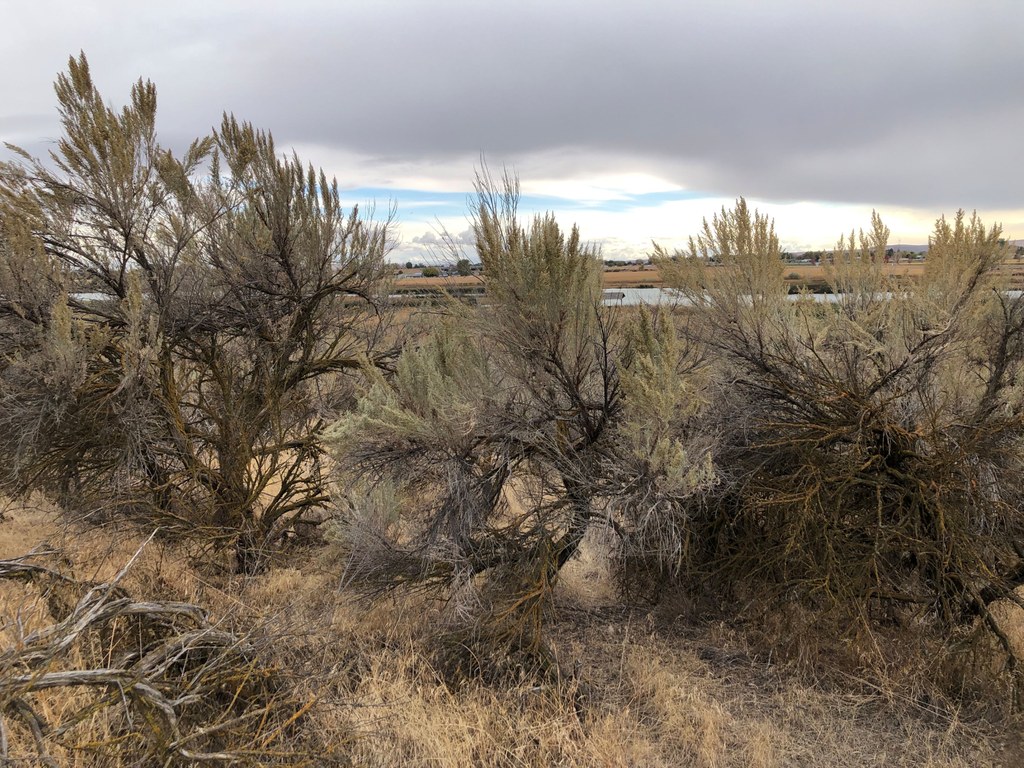
Continue on the trail, reading a few interpretive boards as you go. After about three-quarters of a mile, the trail turns northeast and crosses a footbridge, then ascends slightly into the shrub-steppe habitat. The sagebrush here are enormous — some more than 8 feet tall. The trail curves west and ends in a grove of cottonwood and Russian olive trees. You can return the way you came or try the sandy trail that cuts between some smaller ponds.
Please note that there is no longer a loop trail around Burbank Slough. The kiosk in front of the office and the signboard at the trailhead include outdated maps that illustrate a loop trail, but it is no longer open to the public.
During migration periods, the portion of Burbank Slough east of Lake Road (across from the headquarters buildings) hosts huge flocks of waterfowl including snow geese, Canada geese, swans, and many species of ducks. Bring your binoculars and observe them from the road or the gravel lot adjacent to the road, but please respect the signs that indicate the rest of that area is closed to public access.
WTA Pro Tip: The Environmental Education Center provides opportunities to learn more about the refuge. It’s open from 8:00 a.m. to 4:00 p.m. Monday through Thursday, and 8:00 a.m. to 3:30 p.m. on Friday if staff are available. If the doors are locked during those hours, head into the refuge office and ask them to open it for you.
 Trailhead


