
This trail accesses the popular and rugged Glacier Peak Wilderness. Begin hiking on an old road that climbs steadily and then drops to a junction with the Crystal Lake Trail.
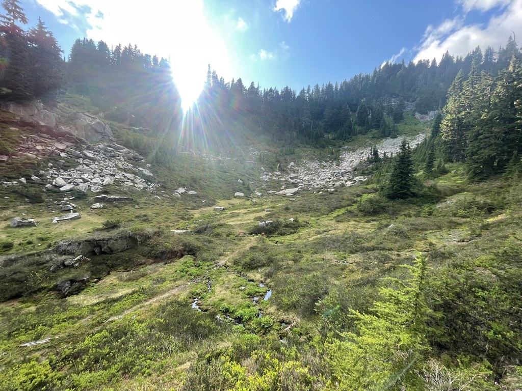
Stay right and continue another four miles to the former road end where the trail takes off to the left, climbing steeply through dense woods before reaching the first meadow. A small stream nearby offers a relaxing place to pause for lunch.
After a rest, continue on for another 1.5 miles to a junction with the Meadow Lake Trail on the left to the east. If you're interested in a dip, drop down 0.7 miles to the 11-acre lake.
If not, the main trail continues on past the lake turnoff, angling up a ridge passing forest and meadows at two miles.
Continue gaining and losing elevation, with numerous switchbacks and excellent views of Glacier Peak. Although camp spots are frequent along the way, the first site with guaranteed water is at 8.5 miles.
Arrive at the ridge crest, which sits at 5,850 feet. From here, you’ll need a compass and map to reach 9.6-acre Diamond Lake at 5,250 feet and 11-acre Emerald Lake at 5,150 feet, since there is not a trail to either lake. They're worth the visit, especially if you're practicing your navigational skills.
The trail continues up and down, remaining below the ridge crest and proceeding through patches of trees, flowers and views. At 12 miles the trail drops steadily as you pass Fire Mountain. Good camping can be found here. This is the point to turn back and return to the trailhead, since the trail peters a little ways past this.
If continuing, the unmaintained trail will drop steeply down switchbacks 4.5 miles to the junction with the former White Chuck Trail, which was obliterated in the 2003 floods. The old route leads west, back to the now decommissioned upper five miles of the Whitechuck River Road 23.
Meadow Mountain

-
 Length
- 35.0 miles, roundtrip
-
 Elevation Gain
- 3,850 feet
-
 Highest Point
- 5,850 feet
Whitechuck Road is washed out near mile 4 and there is a closure in place for motorized vehicles. The Meadow Mountain/Crystal Lake trailhead can still be accessed via foot or bike.
Take three or four days to explore this rugged trail near Glacier Peak. If you're feeling ambitious, make it a traverse either to or from White Chuck Bench.
Continue reading
Hiking Meadow Mountain
Map & Directions
 Trailhead
Before You Go
Whitechuck Road is washed out near mile 4 and there is a closure in place for motorized vehicles. The Meadow Mountain/Crystal Lake trailhead can still be accessed via foot or bike.
Parking Pass/Entry Fee
NoneWTA Pro Tip: Save a copy of our directions before you leave! App-based driving directions aren't always accurate and data connections may be unreliable as you drive to the trailhead.
Getting There
From the Darrington Ranger District office, take the Mountain Loop Highway for nine miles to White Chuck Road (FR 23) and turn left. Follow this road for six miles to Rat Trap Pass Road (FR 27). Turn left and drive 2.4 miles to the trailhead on your right.
It is also possible to access Meadow Mountain from the Suiattle Road. From Darrington, drive Highway 530 north for seven miles to the Suiattle River Road (FR 26) on the right. Follow this road for 10 miles to the junction with FR 25, turn right, crossing the river, and proceed 3.5 miles to Rat Trap Pass/Straight Creek road (FR 27) on the right. Follow FR 27 for 7 miles to the Meadow Mountain/Crystal Lake trailhead on the left.


