
Located only 20 miles east of Seattle and recognized as one of the nation's finest urban wildland trails, the Tiger Mountain Trail goes up and down through Washington's oldest state forest.
Nineteenth century settlers farmed the area nearby and began logging with teams of oxen in the mid-1800s. The logs were brought down the mountain on complex railroads and tramways, by way of elaborate switchbacks and trestles, to mills at Preston, Hobart, and High Point (do you recognize these names? Today, they're popular access points for the trail system on Tiger Mountain.)
Artifacts of those logging operations - such as heavy cables, cranes and remnants of old camps - lie scattered on Tiger, partly hidden by the undergrowth.
At 3004 feet tall, Tiger Mountain is the highest known peak in the range of peaks known as the Issaquah Alps. About 80 miles of hiking trails exist on Tiger Mountain, most of which were constructed and are maintained by dedicated groups of volunteers.
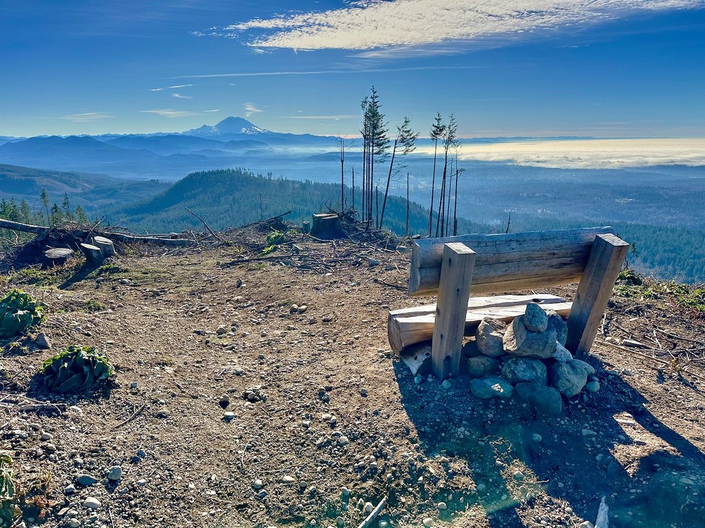
The Middle Tiger Trail is 11 miles one way, and traverses old forests and rocky balds, crossing several creeks and the Fifteen Mile Creek Canyon. The trail, accessible through most of the year, offers walkers a panoramic view, from the Olympic Mountains to the saltwater and lowlands of Puget Sound, and of the Cascade Mountains from Mount Baker to Mount Rainier.
Middle Tiger

-
 Length
- 9.0 miles, roundtrip
-
 Elevation Gain
- 1,127 feet
-
 Highest Point
- 2,607 feet
A short trail on Tiger Mountain that makes up some of the Tiger Mountain Trail thru-hike.
Continue reading
Hiking Middle Tiger

WTA worked here in 2025, 2024 and 2023!
Middle Tiger
Map & Directions
 Trailhead
Before You Go
Parking Pass/Entry Fee
Discover PassWTA Pro Tip: Save a copy of our directions before you leave! App-based driving directions aren't always accurate and data connections may be unreliable as you drive to the trailhead.
Getting There
From I-90, take exit 25. Head south on SR 18 to the Tiger Mountain summit. Here, turn right into a large parking lot. Drive through this lot, then turn left onto a gravel road. Proceed about a quarter mile to a second parking lot on the right. This one offers more room for cars.


