Mount Spokane's Trail 140 is the only trail route extending from the base of the mountain near the park entrance all the way to the summit. With several access points and multiple connecting trails, there are numerous ways to enjoy a visit to this trail. The full one-way trail distance of Trail 140 is 6.1 miles, but this hiking guide entry focuses on Lower 140, a 1.9-mile section that starts near the park boundary at Bear Creek Lodge and ends at Smith Gap.
A good place to start a visit to this portion of the trail is at the former Bear Creek Lodge property. Once privately owned, the lodge is now part of the state park. Washington State Parks is still in the early stages of determining how the former lodge will be used going forward, so for now, the lodge itself is closed to the public, and there are no amenities at this trailhead. The former lodge had its own parking fee, but now that Washington State Parks manages the property, it requires a Discover Pass in the summer and a Sno-park permit in the winter. (Note that this lower trailhead is a staging area for the snowmobile trail system during the winter months, and the short 0.2 mile connector trail from the parking lot to the bottom of Trail 140 is shared-use with snowmobiles.)
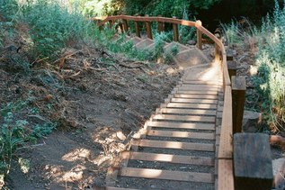
From the parking lot next to Bear Creek Lodge, head uphill 0.2 miles on an old roadbed, then turn right and head uphill beneath the powerlines at the sign for Trail 140. This portion of the trail features several sections of beautiful old-growth forest, but also strays onto adjacent private timberland in one area that crosses an old clear-cut, and has numerous sections that are steeper than recommended for a sustainable trail. The most recent Mount Spokane State Park trail plan recommends a reroute for this portion of the trail in the near future. In the meantime, this section of the trail should be considered difficult due to steep trail grade and erosion damage.
The trail serves as the western boundary for the Burping Brook Natural Forest Area, a special Washington State Parks designation that highlights the unique forest in this area of the park. The bottom of the trail features aspen groves and cottonwoods for fall colors, while large hemlocks and cedars dominate the upper reaches of the trail near Smith Gap.
Smith Gap is a major trail connection, featuring a CXT toilet and picnic table. The Snowshoe Warming Hut is located on the south side of Smith Gap up a short hill, and it is at this point that the Hay Ridge Loop, the Lower Mount Kit Carson Loop Road, and Trail 100 all meet.
Once at Smith Gap, it is worth a stop to enjoy the amenities at this location. There is a CXT toilet and a picnic table adjacent to the Lower Kit Carson Loop Road, and a short hike up the hill above the CXT leads visitors to the cozy snowshoe warming hut. The hut is open to day use year-round, but is an especially welcoming location in the winter. The small cabin has a lovely picnic table hand-built by park volunteers out of a western white pine that fell on the Nordic trail system several years ago, decorative nature panels and historic park signage on the walls, and a small wood-burning stove that helps warm park visitors.
After enjoying Smith Gap, Lower Trail 140 makes a fine out-and-back, but offers even better options for loop routes of varying distances using the other trails that connect to this park hub.
 Trailhead