Trails for everyone, forever

Home Go Hiking Hiking Guide Newhalem Creek

Newhalem Creek

North Cascades > North Cascades Highway - Hwy 20
48.6613, -121.2520 Map & Directions
Length
9.0 miles, roundtrip
Elevation Gain
800 feet
Highest Point
2,000 feet
Calculated Difficulty About Calculated Difficulty
Moderate
Bridge crossing near the confluence of Newhalem Creek. Photo by C P. Full-size image
  • Mountain views
  • Old growth
  • Fall foliage
  • Established campsites
  • Rivers

Hike towards the base of Klawatti and Austera Peaks along Newhalem Creek on this unmaintained North Cascades National Park trail. Years of blowdowns and overgrowth make this trail difficult to hike and navigate, but Newhalem Falls and the views of the mountains cannot be beaten. It's a great way to get into the North Cascades in the winter and still avoid the snow. Continue reading

Rating
4.33 out of 5

(3 votes) Log in to rate

Hiking Newhalem Creek

Hike towards the base of Klawatti and Austera Peaks along Newhalem Creek on this unmaintained North Cascades National Park trail. Years of blowdowns and overgrowth make this trail difficult to hike and navigate, but Newhalem Falls and the views of the mountains cannot be beaten.  It's a great way to get into the North Cascades in the winter and still avoid the snow.

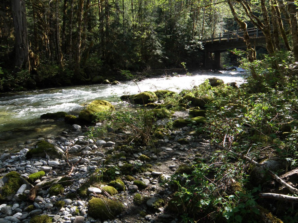
Start from the end of an old Forest Service road at around 1000 feet of elevation. Newhalem Falls, stretching 167 feet, is right at the beginning of the trail. There are a number of smaller creeks that feed Newhalem Creek, providing plenty of water for hikers on a hot day. After just under two miles, there is a small creek crossing, easily managed by rock hopping when the waters are low, but potentially dangerous when the snow is melting.

Just past that, East Fork Newhalem Creek meets with the main creek and the trail. Cross here over a bridge and stop to enjoy a bite to eat or watch as the water rushes by. Continue to follow Newhalem Creek, though not quite as closely. You can hear it, but might not be able to see it. Snowfield Peak is on the left, and a cluster of peaks sits in front of you as you hike the last 2.5 miles to Newhalem Creek Stock Camp. Here, there are campsites with outhouses.

This trail hasn't been maintained in years. Blowdowns cover the whole 4.5 miles in, and it is overgrown in most places. Come prepared for some bushwhacking, but if you push through, this trail will provide solitude, low elevation access to the North Cascades, and creek views and sounds, and a walk through the old growth.

Hike Description Written by
McKenzie Carlson, WTA Correspondent

Newhalem Creek

Map & Directions

Trailhead
Co-ordinates: 48.6613, -121.2520 Open in Google Maps

Before You Go

A $26 backcountry permit is required to camp overnight in North Cascades National Park. Permits must be picked up in person at one of the park's Wilderness Information Centers

See weather forecast

WTA Pro Tip: Save a copy of our directions before you leave! App-based driving directions aren't always accurate and data connections may be unreliable as you drive to the trailhead.

Getting There

From Marblemount, drive northeast on Highway 20 until you reach Newhalem. Turn right to head to the Newhalem Campground. Drive through the campground and go left before the North Cascades Visitor Center, on road signed "Flood Evacuation Route". Follow the unnamed Forest Service road for about a mile until you reach the end of the road. The trail begins here.

More Hike Details

Trailhead

North Cascades > North Cascades Highway - Hwy 20

North Cascades National Park

Guidebooks & Maps

Hidden Hikes in Western Washington

Karen Sykes

Green Trails Maps Diablo Dam

WA - NO 48

You can improve or add to this guidebook entry

Newhalem Creek

28 Trip Reports

Hiked here recently?

Submit a trip report!
 
Trip Reports